Satellites Can See Dark Ships but Cannot Read the Sea: Governance Challenges in Distant-Water Fisheries Transparency
Original Chinese title: 衛星看得見暗船,但看不懂海:遠洋漁業透明化的治理難題
Satellite and AI technologies can enhance transparency in distant-water fisheries, but without local knowledge, evidentiary procedures, and data ethics, transparency may become a new form of power inequality.
Two-Eyed Seeing Lab
Co-authors: 全明正
The Two-Eyed Seeing Lab focuses on the intersection of science, local governance, and cultural data sovereignty. Co-author 全明正 is from the Bunun Shuanglong community and has long observed Indigenous community industries, cultural economies, place branding, coastal and mountain governance, and community collaboration.
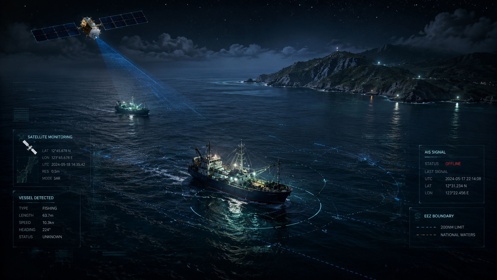
Satellites cast a bright light on the sea surface, but they are neither coast guard units nor moral judges. They can see vessel tracks, nighttime lights, radar reflections, and port movements, yet cannot see fishers' refrigerators, crew members' passports, coastal communities' dining tables, or the power relations behind a fishing permit. In recent years, illegal, unreported, and unregulated fishing has been framed as a highly technological problem: dark vessels with AIS turned off, cross-border transshipment, false-flag vessels, at-sea resupply, and supply-chain laundering. Thus many assume that simply connecting satellites and AI will make the ocean transparent on its own. This idea is charming yet dangerous. Transparency is not about mounting cameras higher; it is about deciding who has the capacity to interpret data, who can raise objections, and who may be wrongly harmed.
Dark Ships Are Not Invisible, They Just Don't Want To Be Seen
Maritime vessels often use Automatic Identification Systems to transmit positions, yet the ocean is never a clean textbook layer. Some ships lack complete signals due to safety concerns, equipment limitations, signal issues, policy constraints, or deliberate avoidance; some shut down positioning in sensitive waters; others keep AIS on but obscure responsibility through transshipment, false registration, or complex corporate structures. Radar satellites, optical satellites, nighttime lights, and machine learning are therefore deployed as supplements: even if you don't say where you are, traces may remain on the sea surface. This is the technical logic of dark ship governance.
But technical logic cannot directly become legal conclusions. A satellite spot does not necessarily indicate illegal fishing; a model trajectory resembling fishing activity does not constitute an enforcement evidence chain. Fishing vessels may be seeking shelter, undergoing repairs, awaiting supplies, or simply experiencing data latency. If public discourse equates "suspected" with "caught," monitoring tools will turn into opinion meat grinders. What ocean governance needs most is not more confident charts but traceable, appealable, and correctable evidentiary procedures.
Open Maps Redistribute Power
The value of platforms like Global Fishing Watch lies not merely in drawing ships on maps but in bringing maritime activities—previously visible only to governments, shipping companies, or a few institutions—to researchers, journalists, conservation groups, and civil society. This transparency reshapes power configurations. When local fishers once said "foreign fleets are coming," their warning could be dismissed as a complaint; now if trajectories, timing, waters, and port data can corroborate each other, local experience is less easily drowned out by management language. Satellites do not speak for locals but provide an evidentiary bridge that gives local knowledge a chance to be heard.
For Indigenous coastal communities and small-scale fisheries this is especially important. Many seas are not just resource warehouses; they also embody rituals, routes, seasonal knowledge, kinship divisions, and local economies. When distant-water fleets, large aquaculture operations, offshore wind farms, tourism vessels, and conservation zones crowd into the same sea, who defines "sustainability" becomes highly political. Relying solely on industrial ship data to govern oceans risks treating small-scale, non-centralized, seasonal, livelihood-based fishing practices as data gaps. Data gaps are not absence of knowledge; they reflect that your system has not learned how to look correctly.
AI Can Catch Patterns and Amplify Bias
AI's role in ocean monitoring is converting massive imagery and trajectories into processable patterns: which ships may be fishing, which areas show abnormally dense activity, which ports and transshipment routes warrant further scrutiny. This is useful because humans cannot watch the entire Earth's sea surface daily. Yet models often feed on available data. The more data favors large vessels, industrial ships, or equipped craft, the better the model understands that world; lacking local-scale, traditional routes, seasonal taboos, and small-boat contexts, models are prone to misclassify unfamiliar behavior as noise or anomalies.
Thus ocean AI must ask not only about accuracy but also representativeness. Which seas inform training data? Do they include tropical islands, Arctic passages, Pacific small islands, nearshore small boats, seasonal fishing methods? Who bears the cost of false positives? If a coastal community is tagged for illegal fishing due to model error, who corrects it? If a large fleet evades detection through data tricks, who gets deceived by false transparency? AI's most frightening aspect is not that it misreads but that its mistakes still look like system answers.
Supply Chains Should Not Just Say Traceable
Seafood supply chains love the term "traceable," as if fish swimming from sea to plate would obediently reveal their origins via a QR code. Reality is far more complex. Crew labor, transshipment, processing, cold chain, importers, brand labels—each segment can dilute responsibility. Satellite monitoring adds external evidence of fishing behavior but cannot replace port inspections, labor rights, customs data, corporate procurement accountability, or consumer communication. If enterprises treat satellite imagery merely as ESG decoration, it is like sticking a dolphin sticker on a dirty fridge: cute but useless.
Genuine fisheries transparency must channel data into action. Which waters need enhanced patrols? Which fleets require stricter transshipment rules? Which purchasers should disclose origins? Which local communities ought to participate in sea governance? Which data cannot be released publicly without endangering the location security of small-scale fishers? Transparency is not dumping everything online; it is ensuring necessary people at appropriate levels obtain sufficient information and can act.
Island Societies Need Co-Governance
Taiwan faces the Pacific and relies on the ocean. For island societies, fisheries governance is not distant international news but food security, local industry, coastal culture, and diplomatic relations. If future satellite monitoring, AI analysis, and open data are introduced into fisheries governance, it should not start solely from large fleets and export markets; coastal Indigenous communities, port communities, small-scale fisheries, local environmental knowledge, and marine education must be included in the design. Otherwise we will get an advanced ocean dashboard yet still miss what people at the shore are saying.
Satellites make the sea surface more transparent, but transparency does not equal fairness. AI makes patterns easier to see, yet patterns do not equal truth. Good ocean governance is about cross-calibrating remote sensing data, on-site enforcement, local knowledge, labor rights, and market accountability. The ocean does not need a new god's-eye view; it needs more honest co-governance. After all, the sea is not merely a blue background for big data—it is many peoples' ancestral homes, workplaces, dining tables, and futures.
From Data Sovereignty to Ocean Transparency
For transparency to truly serve public interest, data sovereignty must be addressed. Maritime data may appear as ship positions but can reveal fishing grounds, seasonal experience, family routes, and local economic strategies. For small-scale fisheries, a good fishing ground is not a coordinate on a map; it is accumulated life knowledge from long-term observation of currents, moon phases, fish schools, wind directions, and taboos. If platforms render all data downloadable, analyzable, and commercially usable in open formats, large capital may enter faster, compressing already fragile local fisheries.
Thus ocean data governance should adopt tiered openness. Data for combating transnational illegal fishing can support research and enforcement at larger scales; data involving local fishing grounds, community safety, and small-boat activity should have community consultation, delayed release, or spatial blurring mechanisms. This is not anti-technology; it is a way to keep technology from turning the details of vulnerable communities' lives into commercial intelligence for more powerful actors. True transparency subjects power to scrutiny instead of exposing local communities. This also reflects Two-Eyed Seeing in ocean governance: placing satellites, models, and regulations on the table alongside the judgments of fishers, crew members, ports, and Indigenous communities. Without the latter, the former can easily become another form of governance from afar.
Further Reading and Sources
- FAO, "The State of World Fisheries and Aquaculture 2024", 2024, Source. Verification considerations: cross-check global fisheries, aquaculture, overfishing, and IUU fisheries governance context; avoid reducing problems to a single country or fleet.
- Global Fishing Watch, "Map / About", continuously updated, Source. Verification considerations: confirm AIS, satellite data, algorithm classification, and platform limitations; do not treat platform detection results as legal convictions.
- Paolo, F. et al., "xView3-SAR: Detecting Dark Fishing Activity Using Synthetic Aperture Radar Imagery", 2022, Source. Verification considerations: cross-check SAR data characteristics for dark ship detection, labeling methods, image limitations, and model tasks.
- Paolo, F. et al., "Satellite mapping reveals extensive industrial activity at sea", Nature, 2024, Source. Verification considerations: cross-check estimates of untracked vessels and marine industrial activity; do not exaggerate as real-time enforcement capability.
AI use and content-safety disclosure
This article was assisted by AI in organizing data, drafting structure, and polishing language; human editors set viewpoints and fact-checking directions