Urban Archaeology Is Not Just Enclosing Ancient Walls: Hydrological Memory in the Era of Torrential Rain
Original Chinese title: 城市考古不是把古牆圈起來:暴雨時代的地下水記憶學
In the era of torrential rain, urban governance cannot treat ancient drainage systems merely as tourist scenery. Underground channels, reservoirs, old city textures and plant growth clues are databases for climate adaptation and the historical interfaces most easily overlooked in public works.
Yuan Media AI Editorial Desk
Consultant: 莊溪
The Yuan Media AI Editorial Desk focuses on technology, cultural policy, public governance and the translation of local knowledge; this piece's consulting committee member 莊溪 has long been committed to plant recognition, natural education and environmental teaching promotion, and was recognized with the Education Dedication Award.
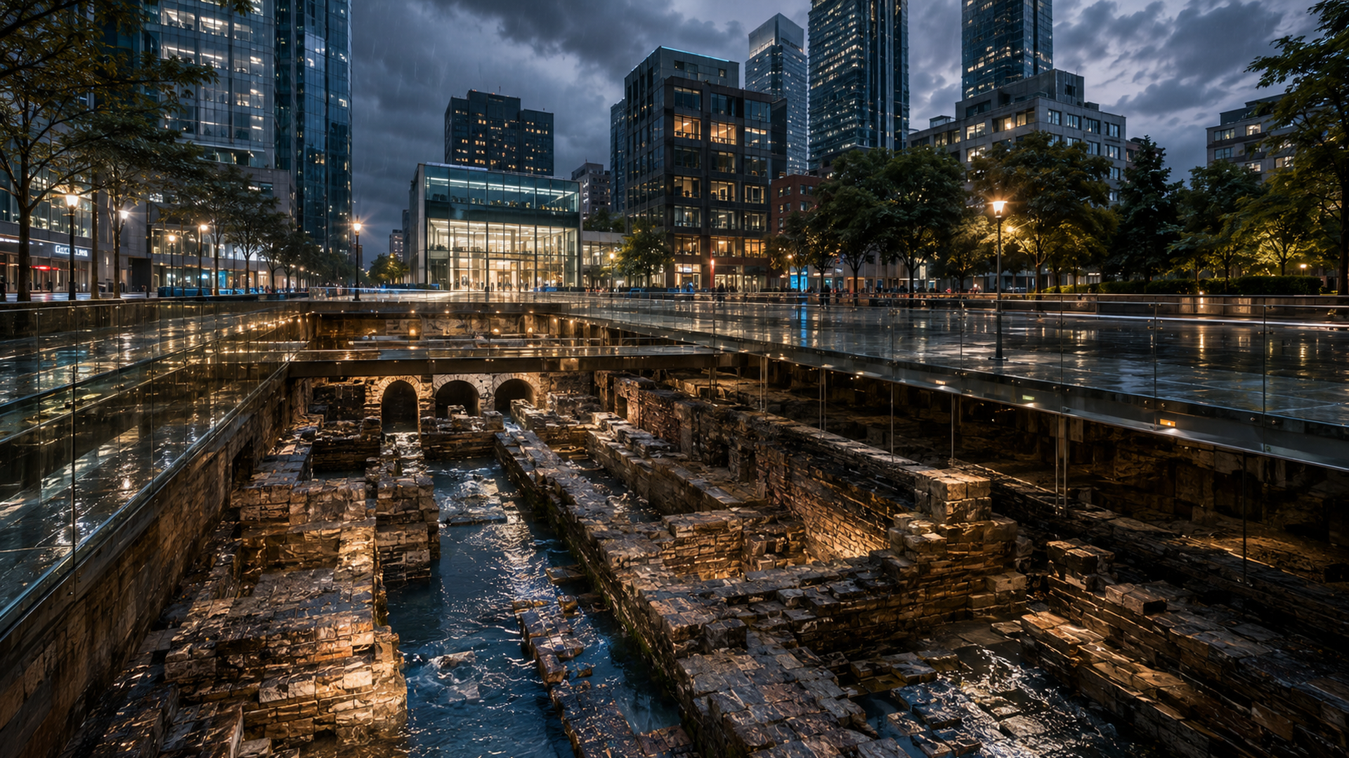
Urban Archaeology Is Not Just Enclosing Ancient Walls: Hydrological Memory in the Era of Torrential Rain
Many cities, when discussing climate adaptation, first pull out engineering drawings: pipe diameters must be enlarged, pumping stations upgraded, detention ponds expanded. All necessary, but if water is treated only as an enemy, cities quickly fall into a modern superstition: drive water away fast enough and disasters will be driven far enough. The problem is that torrential rain does not read urban plans, nor does groundwater automatically respect administrative boundaries because of a presentation.
Urban archaeology suddenly becomes very unromantic here. It is not just excavating ancient walls, pottery shards, street pavements, then letting tourists stand on glass floors to take photos. Truly useful urban archaeology treats underground space as a long-term hydrological record: where were low-lying areas? Where are ancient drainage ditches? Which blocks actually grew along old river channels? Which residences survived droughts with underground reservoirs? Which plant communities suggest soil moisture over time? These questions seem ancient, yet they are closer to reality than many brand-new but amnesiac smart-city dashboards.
Recent cultural heritage and climate risk research point out that climate change exerts compound pressure on site materials, humidity, salinity, foundations and visitor circulation. For cities this is not a small issue for the culture department; it is a public risk faced jointly by drainage, construction, transportation, insurance, tourism and local governance. If ancient waterways are merely seen as obstacles to development, cities are essentially burying their own disaster memory in fill, then spending higher budgets buying new disaster models. This operation is very modern and also absurd.
Sponge Cities Are Not Just Laying Grass: Civilization Wakes When Water Is Acknowledged
"Sponge city" is often spoken as a pretty slogan: more green space, permeable pavement, rain gardens, the city will absorb water like a sponge. This makes sense, but if sponge cities remain only landscape engineering, they end up as another form of decorative governance. Grass is green, yet water still floods; slogans are fresh, underground pipelines still fail.
The real key is not the word "sponge" but whether the city is willing to admit: water does not appear only during torrential rain. Water exists in slopes, in soil, in old blocks, in filled-in ditches, in demolished pools and forgotten wells. Ancient urban storage, drainage, infiltration and recycling systems are of course not all suitable for exact replication; they do not offer nostalgia but scale. They remind us that urban water governance is not a single facility but a set of distributed, maintainable, community-understandable living technologies.
From the perspective of plant education, water memory is also written not only in stone. Where moisture-tolerant plants grow, where exotic grasses appear, where tree roots are long-term compressed by standing water, where moss and ferns expand along wall cracks — these are weak signals of urban hydrology. These signals may not replace instruments but they remind engineers: the surface is not a blank map. Plants are not decorative backgrounds for governance; they are living environmental recorders. If cities are willing to listen, a row of roadside plants sometimes speaks more honestly than an over-beautified consultant report.
Cultural Asset Governance Fears Beautiful Display Without Systemic Connection
The most awkward situation urban archaeology faces is sites preserved as exhibition spaces but not integrated into city systems. An excavation pit may be beside a new station, mall or office building; the structures are lit beautifully, placards written elegantly, yet they have no real connection to drainage planning, underground mall maintenance, rainstorm monitoring or community education. Thus sites become beautiful islands: called cultural assets on one hand, treated as cost, constraint or trouble in actual governance on the other.
This is a blind spot of public culture policy. Cultural assets are not about sealing the past; they are about teaching society to read today's governance problems from history. If a city preserves ancient waterways but does not let water, construction, transport and education departments jointly use their data, it is like locking a precious book in a glass cabinet while claiming to value knowledge. Cities do not need more isolated exhibition spaces; they need site data transformed into public layers usable for planning, education and disaster prevention.
This also involves data ethics. Underground structure data should not be crudely opened to benefit looting, land speculation or excessive tourism; yet it cannot be kept only in the hands of a few experts under protection's name. A more mature approach is graded data: public layer provides historical waterways, terrain memory and educational content; professional layer for engineering and conservation units; sensitive layer includes location protection, community consent and safety control. For cultural assets to live in cities, they must avoid both data colonialism and data confinement.
Public Works in the Torrential Rain Era Must First Learn to Listen to Old Cities
Cities under extreme rainfall cannot rely on a single solution. Large drainage projects remain important, but distributed detention, permeable spaces, wetland restoration, roof water collection, underground space management, community early warning and historical hydrological data are equally vital. Urban archaeology's value is re-linking these scattered clues. It tells us some places do not flood suddenly but are gradually pushed by years of development; some alleys are not poorly drained but originally lie on water paths; some old communities are not backward but retain finer micro-terrain wisdom than new cities.
Many Taiwanese cities, Indigenous townships and foothill towns also have their own water memories: irrigation canals, old river channels, springs, ponds, tribal migration routes, drainage ditches and slope disaster experience. These need not all be romanticized nor forced into tourist material; they should be seriously organized as local climate resilience knowledge assets. True Two-Eyed Seeing does not demean modern engineering nor deify traditional methods; it lets historical landscapes, community experience, sensor data, plant clues and engineering models correct each other.
Ultimately urban archaeology is not reminding us to return to antiquity but to avoid being an amnesiac modern person. Every torrential rain is like an exam: it tests not pump horsepower but whether we understand the terrain, history, waterways and life signals beneath our feet. If the answer always remains "build a bigger pipe," cities will indeed become smarter — smart enough to forget why they keep flooding.
Plants and Old Waterways Are the City's Most Underestimated Sensors
When discussing urban torrential rain, we often imagine sensors as instruments, cameras, radar and water level stations. These devices are important, yet cities always have another batch of slow sensors: plants. Certain trees rot their roots in long-term standing water; certain grasses expand along damp wall feet; certain ferns or mosses hint at humidity, seepage and poor ventilation. Plants do not output dashboards for us but leave environmental notes via growth states. Only urban governance too often treats them as scenery rather than evidence.
This is also where natural education and cultural assets can cooperate. If schools, communities, museums and local gazetteers together record old street plants, springs, post-rain standing water, underground structures and residents' memories, urban archaeology ceases to be only expert excavation and becomes public learning. Children can understand drainage from a waterside plant; residents can read terrain from an old wall; engineering units can correct designs through long-term observation. The best form of public culture is not people reciting dates before exhibition boards but knowing the city beneath their feet still speaks.
Connecting Ancient City Water Memory to the Future
Future climate cities need three capabilities: first, reading the past; second, seeing the present; third, willing to place engineering and local knowledge on the same table. Urban archaeology provides the first capability, sensor data the second, community and plant observation the third. If split apart, governance becomes each speaking its own language: archaeology talks preservation only, engineering capacity only, residents flood experience only, plants relegated as supporting actors in completion photos.
The real path is making cultural assets not just "cannot move" constraints but "must understand" foundational data. Ancient walls are not anti-development; underground waterways are not anti-modern; old plant communities are not backward scenery. Together they remind us: the city's future will not start from a blank base map. Every rain rewrites the exam, every groundwater trace hints at old answers. If modern governance is willing to be humble, ancient cities will not slow the future but may make it flood fewer times.
Sources retained from the Chinese original
AI use and content-safety disclosure
This article was assisted by AI for data organization, structure drafting and sentence polishing; human editors set the viewpoint and fact-checking direction