The Subterranean City Is Not Empty: Ground Penetrating Radar, Digital Twins and the Renegotiation of Development Speed
Original Chinese title: 城市地下不是空白:地中雷達、數位孿生與開發速度如何重新談判遺址
Ground penetrating radar, LiDAR and digital twins allow cities to see underground before excavation, but seeing does not equal protecting; the real question is when data enters decision-making, who can interpret it, and whether development will slow down for history.
山海資料庫
Co-authors: 劉展瑞
Shanhai Database focuses on local history, urban landscapes, cultural heritage, spatial data and public narratives; co-author 劉展瑞 is Indigenous Atayal, serving the Taiwan Association for Promotion of Persons with Disabilities, long-term attention to local governance, public service and Indigenous Peoples' social issues.
I. The Subterranean City Is Most Often Drawn in Grey Because Engineering Drawings Do Not Like Surprises
Urban planning maps have a reassuring cleanliness: roads have lines, sites have frames, floors have numbers; underground is usually assigned to metro, parking lots, pipelines, foundations and flood control facilities. If history appears on the map, it has mostly been organized into a historic site, a tourist spot or a beautiful colour block. The problem is that real urban history does not obey municipal planning zoning, nor will it politely lie only in designated preservation areas.
A city built up over centuries or millennia may have old river channels, settlements, tombs, workshops, roads, war traces, colonial facilities, Indigenous Peoples' landscapes and demolished residences underground. They are not romantic treasures waiting for archaeologists to discover; they continue to affect current land relations. Only urban administration habitually mistakes "not yet registered" for "non-existent," and "nothing excavated" for "nothing there." Thus the most common fate of cultural heritage is to suddenly become important when engineering progress can no longer be reversed.
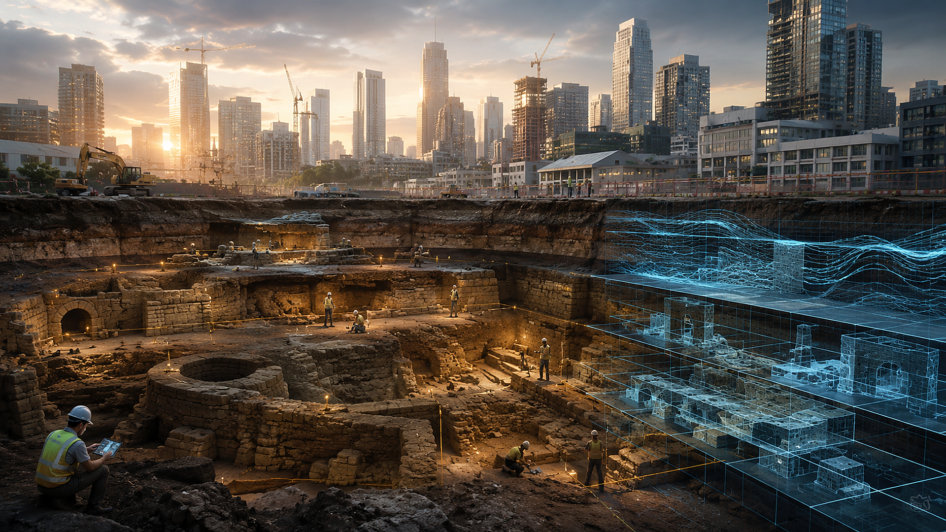
Ground penetrating radar, magnetic surveying, resistivity, LiDAR, historical map overlay and three-dimensional modelling are changing this temporal order. In the past one had to excavate before knowing what was underground; now it is possible to obtain some kind of "incomplete but sufficient warning" imagery before construction. Technology gives cities a chance to know first, then decide. But knowing first also brings more awkward responsibility: since you have already seen, you cannot pretend that bulldozers are just unlucky.
II. Ground Penetrating Radar Is Not an Underground Camera; It Sees Differences, Not Truth Subtitles
Ground penetrating radar is often described by media as taking X-rays of land, as if the instrument pushes past and the screen will show "there is an ancient wall here," "there are tombs there." In reality, radar emits electromagnetic waves and receives reflection differences caused by different materials and moisture states. The arcs, layers and anomalies in the image need to be interpreted combining soil, geology, architectural history, on-site conditions and archaeological experience. Underground pipelines, tree roots, backfill soil, gravel and modern building materials can all produce similar signals.
This uncertainty is not technological failure; it is that urban underground is inherently complex. The problem lies in decision-makers often demanding a non-existent 100% answer from instruments: if they cannot prove there must be a site, construction proceeds as usual; if they cannot draw the complete range, impact is deemed limited. This logic reverses risk responsibility, requiring cultural heritage to first prove it deserves to survive, while engineering does not need to prove it will not cause irreversible damage.
A more reasonable approach is to treat non-destructive detection as a graded decision tool. High-risk anomaly areas should undergo further test excavations, design adjustments or monitoring; data-deficient areas must be marked with uncertainty rather than painted safe green; archaeological assessment should be incorporated into schedules and budgets before development starts, not blamed on cultural heritage "suddenly appearing" after engineering delays. Sites never suddenly appear; it is the system that suddenly cannot ignore them.
III. The Story of LiDAR Discovering Ancient Cities Is Exciting, But More Important Is Old Data Being Re-asked
The 2024 Valeriana Maya city study published used LiDAR data originally collected for environmental monitoring to identify thousands of building structures, plazas, roads, ball courts and water storage facilities. What is most noteworthy about such discoveries is not the technological marvel of laser penetrating forest canopy, but the conversion of data use: a dataset gathered for forests or carbon monitoring becomes evidence of civilizational history under new questions and professional interpretation.
This reminds urban governance that data value should not be determined solely by initial plans. Road surveys, pipeline construction, geological drilling, old aerial photography, urban renewal site investigations and public engineering three-dimensional scans may all contain cultural landscape clues. If these datasets are locked in contractor hard drives, agency systems or obsolete formats, cities will repeatedly spend money remeasuring yet still not know which segment of history they are stepping on.
However, data openness is not simply uploading all coordinates online as progress. Tombs, sacred sites, sensitive locations, unpublished archaeological zones and Indigenous Peoples' cultural landscapes may face looting, tourist intrusion or taboo knowledge leakage. Digital archaeology requires graded access, usage restrictions, community consent and sensitive information masking. Public transparency and cultural protection are not a binary choice; the real difficulty is establishing governance that can explain "who can see, why they can see, what they can do after seeing."
IV. Digital Twins Can Preserve Urban Forms But Will Not Automatically Preserve Urban Relations
Digital twins have recently become a hot term in urban governance. Integrating building, road, terrain, pipeline, traffic and environmental data into three-dimensional models looks like creating for the city a rotatable, simulatable, predictable avatar. If underground archaeological layers are added, it can assist engineering avoidance, risk assessment, display historical strata, and help the public understand rivers, settlements or walls that once existed beneath today's neighbourhoods.
But digital twins may also become exquisite forgetting tools. The most typical case is: first scan a site completely, then announce "digitally preserved," then physically demolish it. This is like filming a high-definition documentary of an old tree about to be cut down, then using the film as compensation. Digital models preserve shape, location and partial information; they cannot replace materiality, sense of place, ritual relations, land rights and community memory.
Therefore three-dimensional scanning should be auxiliary to preservation decisions, not a freebie attached to demolition permits. Models must also record uncertainty and data sources, avoiding rendering that appears overly complete, making speculation look like fact. The most deceptive aspect of archaeological reconstruction for the public is its beauty: missing walls are filled in, vague dates are coloured, disputed uses become navigable spaces; finally everyone forgets what is evidence and what is imagination.
V. The Core of Urban Archaeology Is Not Finding Palaces But Giving Ordinary Lives a Place Again
Media prefer major discoveries: ancient cities, royal tombs, temples, gold and lost civilizations. What truly changes historical understanding in urban archaeology are often less conspicuous things — drainage ditches, food residues, workshop waste, children's toys, rental partitions, temporary settlements, traces of demolished markets and marginal communities' lives. They allow urban history to be written not only by rulers, architects and real estate developers.
Taiwan's urban landscapes also contain multiple temporal layers: Indigenous Peoples' traditional territories, Qing dynasty streets and villages, Japanese colonial facilities, post-war military dependents' villages, industrial settlements, river channel rectification and rapid urbanization overlay each other. If archaeological systems only activate when "ancient enough, complete enough, beautiful enough" structures are found, many modern social histories will be judged unworthy of preservation. Cultural heritage is not an ancientness competition; it is society deciding which experiences can enter public memory.
This also means local residents should not only receive meeting notices after construction fences are erected. Residents' oral accounts, old photographs, place names, ritual paths and life memories can assist interpreting instrument anomalies and point out landscapes invisible to official data. Technology provides underground signals; communities provide meaning; neither can replace the other alone.
VI. Truly Advanced Cities Are Not Those That Dig Fastest But Know Where They Should Slow Down
Engineering speed is often taken as governance capability, delays seen as failure. But for irreversible cultural heritage, slowness is not efficiency's enemy but insurance against permanent errors. If cities integrate historical datasets, non-destructive detection, archaeological risk zoning and community consultation early in planning, they can reduce stoppage conflicts and temporary change costs.
Ground penetrating radar and digital twins will not make value judgments for us. They only make invisible things harder to deny. Ultimately institutions must answer: is a wall base worth preserving? Who has the right to name sites? Whose data belongs where? How are development interests and public memory allocated? When cultural heritage conflicts with housing, traffic, flood control needs, are there truly alternative solutions rather than packaging choices as technological inevitabilities?
The subterranean city is not empty; it is simply long absent from the field of power. If technology can bring history into meeting rooms earlier, that is already a major advance; but if meeting rooms treat it only as a risk layer to be eliminated, no matter how high-resolution the radar, it will merely improve bulldozer navigation.
Sources retained from the Chinese original
AI use and content-safety disclosure
This article was assisted by AI for data organization, structural drafting and sentence polishing; human editors set viewpoints and fact-checking directions