The Second City Beneath Our Feet: Governing Underground Utilities, Archaeological Remains, and Digital Twins
Original Chinese title: 城市腳下的第二座城:地下管線、考古遺構與數位孿生的治理戰
When cities build digital twins, the hardest subjects are rarely skyscrapers, but the hidden utilities, geological strata, tree roots, hydrology, and cultural assets whose records conflict across versions and responsible agencies.
Yuan Media AI Editorial Desk
Consultant: 莊溪
The Yuan Media AI Editorial Desk focuses on technology, public governance, and the translation of cultural knowledge. 莊溪 has long worked in plant education, nature observation, and public environmental education, and is a recipient of the Education Contribution Award.
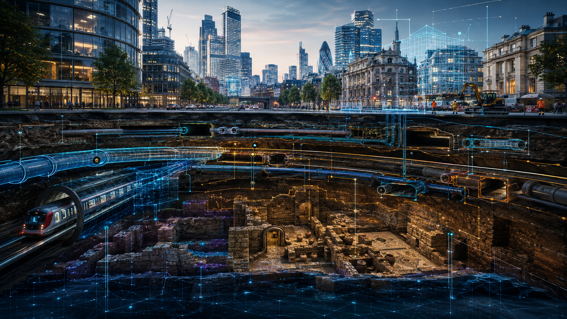
The Most Honest Place in the City Is Beneath the Asphalt
City promotional films love skylines. Glass curtain walls, metro trains, driverless buses, and brightly lit riverbanks evoke a future city already running smoothly under algorithmic management. Yet the systems that determine whether a city actually works are usually out of camera range: water and sewer pipes, gas mains, power and communications cables, underpasses, metro structures, former river channels, tree roots, and layers of historical remains buried beneath newer construction.
These systems are not neatly stacked building blocks. They are more like a drawing passed among administrators from several different eras—until the original was lost and a blurred photocopy was scanned into a PDF. In many cities, information about the underground is scattered among agencies, contractors, paper atlases, and veteran engineers’ memories. Only when roadwork strikes a utility, causes a leak or outage, destabilizes a tree, or damages cultural heritage does it become clear that a “smart city” data center may know less about the ground below than a local plumber or a longtime volunteer tree monitor.
The real test of an urban digital twin, then, is not whether it can render an attractive three-dimensional city. It is whether the model can represent the versions, accuracy, accountability, and uncertainty of underground data. A model that includes visible features such as building heights, traffic flows, and commercial districts while omitting utilities, mature tree roots, cultural layers, and groundwater is not a digital twin. It is a city taking a selfie.
A Digital Twin Is Not a 3D Animation but a Framework for Accountable Decisions
A “digital twin” is often reduced to a three-dimensional city that users can rotate, zoom, and test for sunlight. Such imagery works well in presentations and can make a budget look technologically sophisticated. But unless the model is continuously updated, identifies its data sources, and connects to actual sensors and maintenance records, it is little more than an expensive architectural model. A genuine urban digital twin must answer at least four questions: Do its objects correspond to real facilities? How often is the data updated? Who is accountable for errors? And can the model support concrete decisions, including pre-construction risk assessments, flood-path forecasts, traffic diversions, emergency repairs, and cultural-heritage protection?
Underground systems are particularly difficult. Above-ground buildings can be checked repeatedly against aerial photography, street-level imagery, or building information models. Underground utilities may be documented only in historical drawings and partial surveys. A location might be described simply as “one meter from the roadside,” or it may have shifted because of road widening, coordinate-system conversion, or changes made during construction. The most dangerous error is not a complete absence of data, but data that looks precise while resting on a forty-year-old estimate.
A mature digital twin must show not only where a utility is believed to be, but also how certain that location is. Accuracy, source date, detection method, responsible maintenance agency, and most recent verification should all be part of the model. If urban governance cannot label what remains unknown, it merely packages uncertainty as a dashboard and conceals risk behind a polished interface.
Underground Utilities Are Both a Public-Safety Issue and a Data-Governance Issue
Underground asset management is often treated as an internal matter for engineering departments, but it is a citywide public-safety issue. Striking a gas main can cause an explosion. Cutting a communications cable can disconnect an entire area. A ruptured water main can wash out the roadbed. The absurdity at many worksites is that every agency has its own map, yet none of those maps provides a shared account of reality. However animated the pre-construction meeting may be, excavation can reveal that the real chair of the meeting is an undocumented old pipe.
The barriers to a unified underground-asset database are not only technical. Agencies may be concerned about information security, commercial confidentiality, or liability. Contractors may fail to return as-built records in reusable formats after a project is completed. Local governments may lack staff for long-term maintenance. The familiar result is broad agreement that integration matters, coupled with an expectation that someone else should hand over their data first. This is why a digital twin must be treated as a governance system rather than a procurement project. Cities need common data standards, assigned responsibility for updates, tiered access, and mechanisms for reporting errors. Sensitive facilities need not be visible to the public, but secrecy cannot leave frontline crews digging inside an information blackout.
Data security and construction safety are not opposing choices. Tiered authorization can protect both. Few people need access to everything, but those responsible for construction cannot be denied all meaningful information. The danger is not that a city has too much data; it is that the data remains locked inside separate agencies, like underground ghosts that never speak to one another.
Tree Roots, Hydrology, and Archaeological Remains Also Belong to the Underground City
The underground city contains more than utilities. Mature tree roots, groundwater, permeable strata, and compacted soil also shape urban safety. Street trees are not decorations placed on the surface; their roots compete with pipes, pavement, and drainage infrastructure for space. A digital twin that renders the canopy as a green object but ignores the rooting zone and soil conditions misses a basic reality of urban ecology. Consultant 莊溪 has long stressed that plants are not landscape textures. They are living organisms that continue to grow, breathe, and interact with their surroundings. A city cannot claim resilience by planting trees for photographs while concrete, utilities, and poor construction slowly suffocate their roots below ground.
Another category of underground information is often treated as an inconvenience on a construction schedule: archaeological remains. Former city walls, burials, settlement layers, ancient wells, old river channels, and industrial structures may not be discovered until excavation begins. For a project manager, the discovery may mean suspending work, conducting an investigation, and revising the design. For the history of a city, it may be crucial evidence of how the place came into being.
Smart-city models readily reduce cultural heritage to a static layer, as though placing a red dot on a map were enough to protect it. Archaeological data, however, is uncertain and varies in sensitivity. Some locations cannot be disclosed in full because doing so could invite looting. The boundaries of some remains are only inferred. Some cultural meanings require interpretation with particular communities or researchers. A model that pursues total visibility can turn a tool for protection into a tool for exposure.
The More Polished the Model, the More Honestly It Must Represent What Is Unknown
Digital systems have a dangerous allure: once information appears in a three-dimensional model, people are inclined to believe it. A dashed line on a plan looks provisional; a brightly colored pipe in a 3D scene looks like a fact. Visualization can improve understanding, but it can also magnify false confidence. Urban digital twins therefore need interfaces for uncertainty—for example, varying transparency to show positional accuracy, timelines to show the age of records, and warning symbols for sections that have not been verified in the field. Users should also be able to trace every item back to its source rather than seeing a polished object with no chain of accountability.
That design may appear less spectacular, but it is more consistent with scientific and engineering ethics. A reliable system does not claim omniscience. It distinguishes what is known from what is not and explains how the remaining uncertainty can be resolved. Urban data also reflects social hierarchy. City centers, science parks, and the areas surrounding major construction projects often have relatively complete records, while older neighborhoods, mountain towns, peripheral areas, and informally used spaces may be neglected for decades. If resources are allocated according to data completeness, poorly documented places become even harder to improve: they are not prioritized because they are invisible, and they remain invisible because they are never prioritized.
If digital twins are to become tools of public governance, they cannot serve only high-value development districts. Areas with dense aging utilities, high disaster risk, older populations, or inadequate maintenance capacity may have the greatest need for better data. The value of public digital infrastructure lies not in making a city resemble a video game, but in making its most easily overlooked risks visible.
Taiwan’s Cities Do Not Need Another Showcase Center
Underground space in Taiwan’s cities is complex, and typhoons, earthquakes, flooding, and repeated road excavation make it harder to manage. If every city and county independently buys a closed platform, the result may be even more data silos. What Taiwan needs instead are cross-agency standards, sustainable update processes, the capacity to verify conditions in the field, and shared interfaces linking engineering, cultural heritage, urban trees, disaster preparedness, and public communication.
Digital twins can be valuable, but only if cities are prepared to address the issues that do not belong in promotional films: erroneous data, conflicting responsibilities, aging records, sensitive locations, rooting space, and long-term maintenance budgets. Otherwise, a city acquires an exquisite virtual model while excavation below ground still depends on guesswork. Technology has merely added lighting effects to an old problem.
The second city beneath our feet is more than a collection of engineered facilities. It is also an accumulation of history, institutions, plant life, and responsibility. The purpose of a digital twin should not be to turn everything into a rotatable image, but to let decision-makers see risk before excavation, trace responsibility after an accident, preserve history during renewal, and account for the city’s seemingly quiet trees and soils. A city’s intelligence is measured not by the number of its screens, but by its willingness to confront what cannot readily be seen.
Bringing Natural Knowledge Back into Urban Engineering
One of the most neglected facts in underground governance is that natural knowledge and engineering knowledge should not be separated. Why are mature trees more likely to fall along certain roads? Why do drains begin to overflow after a particular amount of rain? Why does construction in some blocks repeatedly uncover old foundations or former waterways? The answers may reside not only in mapped data, but also in the experience of people who have watched these places over time.
Plant educators, residents, maintenance crews, and local historians may each hold one part of the puzzle. A digital twin that draws only from central databases and excludes local observation produces a city without memory. A better approach would establish a verifiable local reporting mechanism through which unusual tree conditions, pavement subsidence, recurring waterlogging, suspected archaeological remains, and discrepancies between utility maps and conditions on the ground can enter a formal workflow for professional review. This is not a transfer of expert authority to the crowd. It is an acknowledgment that urban governance requires more than one set of eyes. A genuinely smart city should allow professional records and field observations to correct one another, rather than permanently excluding those who know the place best.
Digital urban governance needs more than central servers; it also needs an institutional channel for feedback from the field. Every excavation, replacement planting, and renovation of an older building should become an opportunity to update underground records. If information is organized only for major engineering projects, the small clues revealed through routine maintenance will disappear. A city is not a model built once. It is a living system that changes every day.
Sources retained from the Chinese original
AI use and content-safety disclosure
AI assisted with research organization, structural drafting, and language editing. Human editors set the article’s perspective and established its fact-checking priorities.