The City's Underground Is Not Blank: Old River Channels, Archaeological Layers and Digital Twins Rewriting Urban Governance
Original Chinese title: 城市的地下不是空白:舊河道、考古圖層與數位孿生如何改寫都市治理
A city's truly expensive places are often not the buildings above ground, but its buried history. Old river channels, filled wetlands, archaeological layers and underground pipelines overlap, forcing urban governance to stop treating the subsoil as a blank layer. Digital twins that only simulate above-ground traffic and housing prices equal deliberate blindness at the most critical point.
山海資料庫
Co-authors: 李文驤
Shanhai Database focuses on urban landscapes, spatial data and public governance; 李文驤 is a geography teacher at Catholic Daren High School, participating in geography education and local space observation.
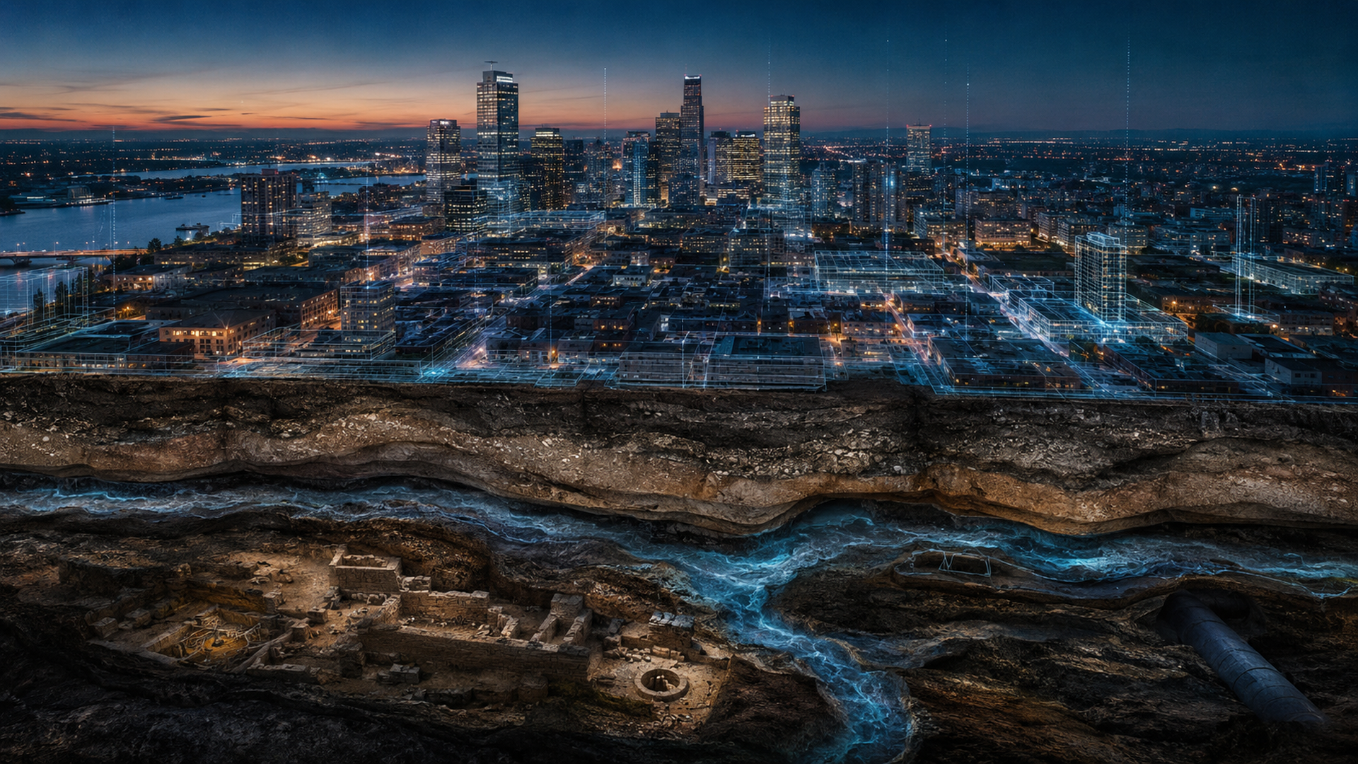
Modern cities excel at growing upward but rarely look downward. Skyscrapers, metro lines, office towers, landscape residential developments and redevelopment billboard advertisements always portray the future as a sum of glass curtain walls and skybridge systems; what lies buried underground is usually only remembered when engineering accidents occur, roads subside, cultural layers are excavated or torrential rain turns underground spaces into temporary aquariums. At that moment everyone suddenly realizes: originally the underground was not blank. It contains old river channels, filled ponds, fault influences, intersecting pipelines, burial sites and settlement remains, as well as governance exams left by previous generations for today. We have long pretended not to see it because seeing would mean engineering could no longer be so casual and development could no longer be so self-righteous.
Old River Channels Will Remember How Water Once Flowed
First discuss the old river channels most often underestimated. Many cities, during rapid expansion, straightened originally winding rivers, filled ponds, wetlands and low-lying areas with roads and buildings covering them. The surface looks flat and tidy as if history has been thoroughly rewritten; but hydrological memory does not behave so obediently. When heavy rain comes, the former waterways will speak again through flooding, subsurface seepage, unstable soil layers or pressure on infrastructure foundations. This is why some regions are reminded each time torrential rain falls: you thought that area was a parking lot, yet water always remembers it was once a pond. If cities do not incorporate old river channels into governance models, disasters will teach the lesson in the most straightforward way.
Archaeological Layers Are Not Engineering Obstacles
Next is archaeological layers. Cities often like to treat archaeology as development obstacles, as if excavating a site makes engineering unlucky, delays schedules and generates public complaints. This mindset is actually short-sighted. Archaeology does not aim to stop cities but helps them understand themselves. Where underground settlement remains, ancient irrigation systems, early industrial traces, burial sites or trade artifacts exist, that land once had different uses, ethnic activities and ecological conditions. These are not merely cultural assets; they are spatial governance intelligence. They remind planners: today's blocks did not start from zero; the subsoil carries longer time depth. If cities only value floor area ratios but ignore cultural layers, it is like a person who can only recite their own resume yet does not recognize family history. It appears efficient but is actually fragile.
Digital Twins Cannot Be Only Above-Half Body Photos
At this point "digital twins" truly become meaningful. Many cities recently discuss digital twin technology, often focusing on traffic flow, energy use, building management and real-time monitoring; these are important, yet if models only simulate visible above-ground systems without incorporating underground layers, they are not twins but merely pretty half-body photos. A mature urban digital twin should integrate old maps, cadastral changes, geological cross-sections, archaeological surveys, underground pipelines, hydrological data, subsidence information and land development history so decision-makers can see risks and constraints before planning a road, metro exit or underground parking lot. This will not slow engineering but reduce disasters. The difference lies in that the former requires governance patience while the latter usually learns through accidents.
Without Data Integration Platforms Are Just Advanced Puzzle Tables
Subsoil governance also involves cross-departmental cooperation's old problem. Archaeological data may be held by cultural units, pipeline data by public works or utility systems, geotechnical information by consulting firms, flood records scattered in water and local government reports, while old maps lie in archives or researchers' hard drives. Everyone has their own data but lacks a common language; thus each integration discussion becomes like a large matchmaking disaster: parties know each other exists yet rarely truly converse. This is why urban subsoil information work is not merely technical but institutional. Without data format standards, responsibility division and sharing mechanisms, even the best platforms are just advanced puzzle tables.
Underground History Is Also Public Education
For Taiwan this task carries an additional public education meaning because we have become too accustomed to treating cities as fixed finished products, forgetting they are actually layered: rivers diverted, farmland redeveloped, settlements swallowed, industrial zones transformed, sites preserved or ignored; all above-ground order is built upon layers of folded history underground. If citizens cannot see these layers, public discourse easily degenerates into short-term arguments such as "why can't we build here," "why is engineering so slow" and "why does rain flood." Many answers lie underground but we have long not treated the subsoil as public knowledge.
Land Is Not Blank Paper: A Reminder Shared by Indigenous Townships and Cities
Going further, subsoil layer governance and indigenous township public services, disaster resilience are also not unrelated. Mountain road slopesides, old settlement remains, tribal periphery hydrological paths, ancient trails and settlement memories within traditional territories themselves constitute another kind of "subsoil/stratum governance" problem. Although cities and indigenous townships face different contexts they both confront the same reminder: land is not blank paper; planning cannot pretend to start from zero. Two-Eyed Seeing's value here does not romanticize traditional knowledge but acknowledges that local memory, historical landscapes and modern survey data can mutually correct each other. Maps exist not only on screens but also in elders' narratives; risks are not only within models but also in long-term observed landscape experiences.
Making Visible the Subsoil Should Be Listed as Basic Governance Capability
If urban governance truly wants to upgrade it should list "seeing the subsoil" as a basic capability rather than an optional accessory. This includes: establishing cross-database overlay review before major engineering projects; incorporating old river channels and cultural layers into digital twin platforms; making archaeological surveys not merely statutory procedures but pre-planning intelligence; creating public-understandable underground landscape education interfaces; and reviewing historical geomorphology and land changes in disaster governance. These tasks are not glamorous nor easy to turn into investment brochures yet they approach true modernization more closely than any future city rendering image.
The city's underground is not blank; it has simply been treated as blank by too many people. When we finally admit that beneath lies the past, risks, culture, hydrological memory and governance responsibility digital twins will no longer be mere showmanship but become a more honest urban methodology: see first then decide; understand layering before discussing development. Otherwise those who treat underground as blank today may tomorrow have to learn in news footage that blanks can actually bite back.
Public Informedness Is Also Part of Subsoil Governance
Additionally subsoil governance involves democratic issues of information visualization. If underground risks and historical layers are only understandable by engineers public participation cannot truly be established. Good systems must serve not only professional departments but also enable citizens to understand basic background when facing major development projects, road construction and disaster plans: what geomorphology this area once had, known risks and why certain engineering requires more caution. Public informedness is not a procedural add-on but a necessary condition for governance to avoid repeated conflicts. From this perspective subsoil data governance is also part of urban democratic governance.
Further Reading and Data Sources
- UN-Habitat《World Smart Cities Outlook 2024》|Date: 2024|Verification considerations: confirm people-centric smart cities, public digital infrastructure, resilience and governance frameworks.
- UK Government National Underground Asset Register (NUAR)|Date: continuously updated since 2022|Verification considerations: confirm integration of underground pipelines and cable data, public safety and cross-agency sharing mechanisms.
- Ministry of Culture Cultural Assets Bureau: National Cultural Assets Network|Date: continuously updated|Verification considerations: confirm official Taiwan archaeological sites, artifacts, cultural landscapes and cultural asset classification data.
- Directorate-General of Land Surveying Center: Land Surveying Data Service Cloud|Date: continuously updated|Verification considerations: cross-check topographic maps, orthophotos, cadastral and multi-layer overlay spatial information services.
- Ministry of Economic Affairs Water Resources Bureau: Subsidence Conditions|Date: updated annually per monitoring|Verification considerations: confirm Taiwan subsidence monitoring and annual inspection overview.
AI use and content-safety disclosure
This article was assisted by AI for data organization, structure drafting and sentence polishing; human editors set the viewpoint and fact-checking direction