Wanli Creek Is Not Safe Just Because an Alert Is Lifted: Before and After a Landslide-Dammed Lake Overflows, the Real Danger Is Reading Risk as a Single Signal
Original Chinese title: 萬里溪不是解除警戒就沒事:堰塞湖溢流前後,真正危險的是把風險讀成一個燈號
The landslide-dammed lake upstream of Wanli Creek shows that lifting one alert level does not mean risk has disappeared from the valley. This article reexamines risk governance through natural-dam monitoring, redundant sensing, model limitations, river-channel access restrictions, local evacuation, and Two-Eyed Seeing.
Yuan Media AI Editorial Desk
Yuan Media AI Editorial Desk focuses on Indigenous township public services, disaster governance, technology monitoring, and local risk communication. Articles are based on editorial verification and cross-checking with official sources.
I. Wanli Creek is not safe just because the alert has been lifted
After a landslide-dammed lake formed upstream of Wanli Creek, public concern focused on straightforward questions: Will it breach? Will water flood Provincial Highway 9, the railway, and downstream settlements? When will alerts be lifted?
These are reasonable concerns. But if public discourse reduces to red light, yellow light, and alert lifting, a complex mountain disaster is misread as a traffic signal. Red means danger; yellow means caution; lights off means it’s over. Yet natural dams are not concrete reservoirs, and alert adjustments do not mean risk vanishes from the valley. They simply indicate that at a specific moment, under a particular set of monitoring data and rainfall assumptions, response strategies have changed.
The greater public value of the Wanli Creek incident lies in forcing us to rethink risk governance: monitoring equipment is not infallible oracles; models are not permanent guarantees; evacuation is not merely moving people from one point to another. Mature governance must clearly articulate conditions, scope, backups, and responsibilities.
II. Landscape reorganization beginning with a 45-hectare collapse
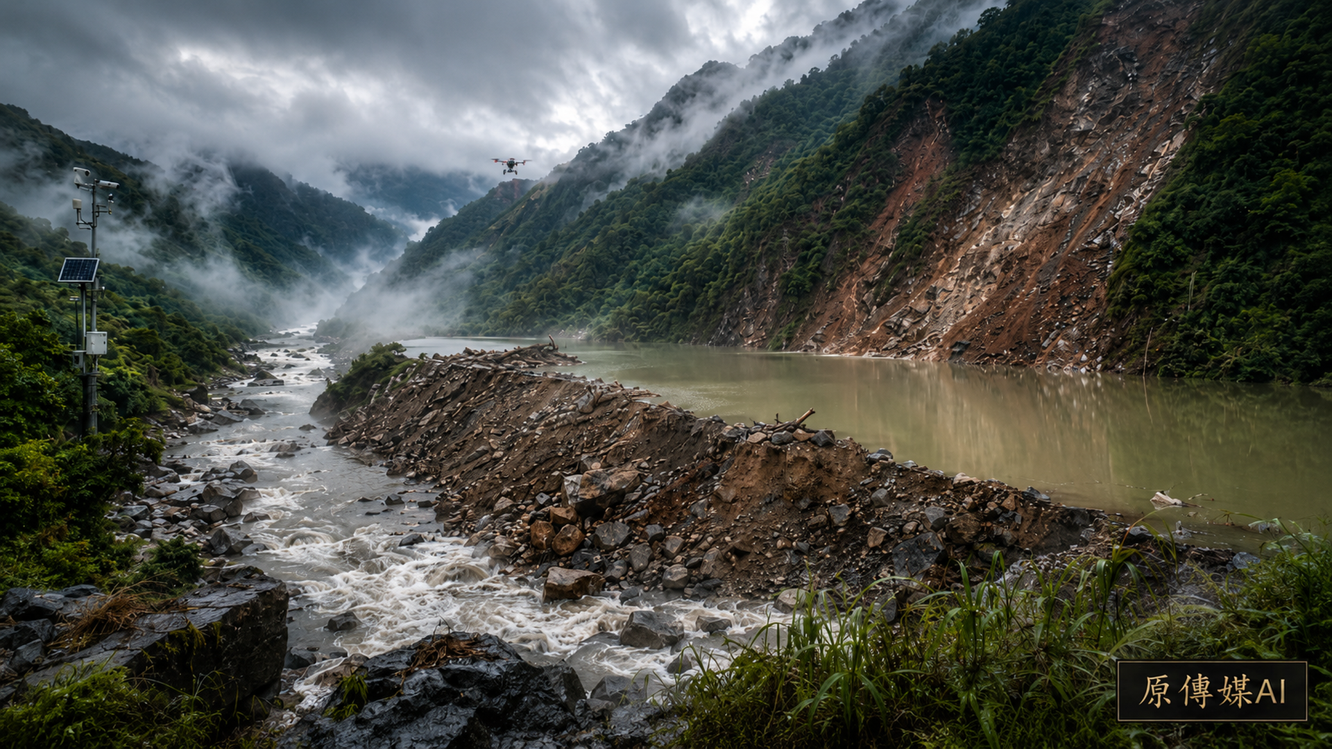
According to the preliminary aerial survey by the Forestry and Nature Conservation Agency's Hualien Branch, a large-scale collapse of approximately 45 hectares on the right bank at the boundary between Compartments 82 and 96 in the Lintianshan Forest District blocked the river channel, forming a landslide-dammed lake. The site is about 30 kilometers upstream along Wanli Creek from the Provincial Highway 9 Wanli Creek Bridge; the gorge is steep and forest roads have collapsed, making rapid access for personnel and heavy machinery difficult.
First, we must clarify: a landslide-dammed lake does not suddenly add a manageable reservoir to the valley. Instead, water, sediment, and slope mechanics across the entire section are rearranged. The collapse debris may mix boulders, soil, sand, trees, and fractured rock layers; water can seep through the dam surface, cracks, and underground flow paths. Even if it appears “undamaged,” internal seepage channels continue to evolve.
According to Report No. 13, issued on July 20, the natural dam stands about 108 meters high with a volume of roughly 7,250,000 cubic meters; initial estimates placed maximum storage at around 5,100,000 cubic meters. By 2:30 p.m. on July 20, water level reached elevation 1,089.03 meters with a volume of approximately 5,698,000 cubic meters. These figures exceed the original storage estimate—not because physical laws fail, but because terrain models, overflow elevations, lake basin boundaries, and actual water conditions are continuously corrected as new aerial survey data arrive.
Risk from a natural dam cannot be judged solely by “how much water is there now.” Dam material uniformity, seepage concentration, ongoing upstream collapses, river-channel blockage by floating debris, and torrential rain inflow can all alter future development. Each new drone flight, LiDAR terrain scan, or water level measurement revises prior judgments rather than stamping the valley as final.
III. Water gauge failures expose not equipment issues but decision philosophy
On July 19, the first water gauge showed intermittent anomalies; officials cross-checked with a second backup gauge, aerial imagery, and other data to confirm no overflow had begun. This appears merely an instrument fault, yet it reveals a core principle of modern disaster governance: major decisions cannot hinge on a single sensor.
Mountain equipment faces lightning strikes, power outages, communication delays, satellite obstruction, humidity, rockfalls, and battery failures. A truly reliable system does not pretend instruments never fail; it incorporates backups and human interpretation. Water gauges, drones, LiDAR, rainfall forecasts, seepage rates, on-site bridge monitoring, and resident observations must mutually validate.
If a system only translates one number into a red alert, it looks automated but may lack wisdom. Disaster decision-making fears not insufficient data, but abundant data without clear statements about which entries might be wrong, delayed, or based on uncertain assumptions.
Sensor credibility cannot wait for equipment failure to be discussed. Public dashboards should display update times, data sources, device status, and whether backup data are used. Sudden value jumps must carry anomaly flags rather than leaving the public guessing whether floodwaters have arrived or signals have dropped.
IV. The Yellow Alert Was Lifted, but the River Channel Remains Under Red Access Restrictions
Report No. 12, issued on the morning of July 20 temporarily adjusted settlement and traffic alerts from red to yellow; the same afternoon’s 13th report saw the Central Disaster Response Conference lift the yellow alert, yet river channels downstream of Wanli Creek and outside the levees remained under red access restrictions—prohibiting personnel, vehicles, and construction machinery from entering the channel.
This state—“the settlement alert has been lifted, but the river channel remains under red restrictions”— is easily compressed in headlines to “alert lifted.” The two are not contradictory: simulations suggest that without torrential rain, even if overflow or partial dam breach occurs, floodwaters would largely stay within levee channels. However, water levels and velocities inside the channel, floating debris, and sudden sediment surges can still pose lethal risks to construction workers, tourists, foragers, and machinery.
Thus, what must be communicated is not a binary “safe” or “still dangerous,” but: which areas are cleared? Which remain controlled? Who may return? Which vulnerable residents still need pre-emptive evacuation? Which bridges and public facilities continue monitoring?
Alert information that shows only colors without a geographic scope, affected groups, and action instructions delivers emotion rather than executable guidance. Governance systems should present river channels, roads, settlements, bridges, and public facilities separately to avoid a single light erasing differences.
V. Models do not say “absolutely no risk,” only that under certain conditions risk is manageable
Official overflow flood simulations indicate that in specific scenarios, floodwaters will not cross the Provincial Highway 9 Wanli Creek Bridge or the Taiwan Railways New Wanli Creek Bridge decks; the July 20 13th report also notes that without torrential rain, even if a landslide-dammed lake breaches via overflow, floods may still be confined within levee channels.
These judgments are crucial but must not be translated into permanent guarantees. Models necessarily rest on assumptions about dam breach modes, flow rates, sediment concentration, river cross-sections, bridge flood capacity, and rainfall scenarios. If the dam experiences different scouring patterns, upstream collapses recur, torrential rain alters inflow, or floating debris blocks bridge openings, outcomes may diverge.
Good risk communication does not hide uncertainty out of fear of panic; instead it tells people: what current judgments are based on; under which conditions alerts would restart; and that bridges, river channels, water treatment plants, intake facilities, and substations remain monitored.
“Models show manageable risk” and “no risk at all” convey fundamentally different messages. The former is a scientific assessment; the latter often reflects public relations wishes.
VI. Downstream governance cannot be only evacuation; it must also include livelihood recovery
Landslide-dammed lake management extends beyond flood control. Even without major breach, downstream residents may face prolonged uncertainty: can residents access their farmland? Can construction resume? Are water intakes affected by sediment? Will older adults and people with limited mobility have to evacuate repeatedly? How do homestays, transport, and local industries cope with risk labels?
Each red alert mobilizes police and fire services, township offices, village and neighborhood officials, transportation agencies, social welfare providers, and shelter systems. Evacuation is not merely moving people from one map point to another; it involves medications, caregivers, pets, vehicles, work, and family relationships. When alerts rise and fall repeatedly, residents may experience alert fatigue, beginning to question whether the next evacuation will be necessary.
Thus, the Wanli Creek incident should prompt governments to establish more comprehensive post-evacuation assessments: who lost income due to evacuation? What transportation and caregiving support do vulnerable households need? How do residents receive the next alert after returning home? How are the river channel's red access restrictions clearly marked rather than buried in official annexes?
Risk governance that calculates only flood depth but ignores residents’ lived costs underestimates the true harm disasters inflict.
VII. Indigenous communities and local residents are not merely informed parties; they constitute part of risk knowledge
The Wanli Creek basin is not an empty terrain map. Residents of Wanrong Township and Fenglin Township possess long-standing experiential knowledge about river channels, bridges, water intakes, mountain roads, and rainfall patterns. This experience cannot replace water gauges or hydraulic models but can supplement what instruments miss: water color, sound, floating debris, odors, tributary changes, and road seepage.
True Two-Eyed Seeing does not mean the government finishes its model before explaining to local communities; it means integrating local observations into risk assessment and monitoring design. Which locations need cameras? How should messages be disseminated via village and neighborhood broadcasts, LINE, text messages, or phone trees? Which households need assistance at least two hours in advance? These answers do not reside solely in central databases.
Local participation should not occur only during emergencies. Monitoring equipment placement, data disclosure scope, alert thresholds, evacuation routes, and drills must involve residents substantively. Otherwise even advanced systems may lose trust when action is truly needed.
Conclusion: What is lifted is an alert level, not the valley’s uncertainty
The Wanli Creek landslide-dammed lake reminds us that disaster governance maturity lies not in quickly announcing alert lifting but in precisely stating what has been cleared, what remains uncertain, who cannot yet enter, and under which conditions alerts would restart.
Natural dams may gradually form stable overflow channels or alter due to torrential rain, earthquakes, or further collapses. Monitoring must continue despite waning news attention; river-channel management cannot rely on a few sensors alone. Equipment needs backups; models require version records; local participation is essential; vulnerable evacuations demand longer time horizons.
What we truly should learn is not to reduce risk to a color, but to understand the conditions, spaces, and responsibilities behind that color.
Sources retained from the Chinese original
AI use and content-safety disclosure
This article was assisted by AI for data organization, structural drafting, and sentence polishing; human editors set the viewpoint and fact-checking direction, with verification considerations retained for item-by-item human review.