Maps Can Give Directions Without Understanding Place: The Boundaries Navigation Platforms Must Respect in Handling Indigenous Place Names and Data Sovereignty
Original Chinese title: 地圖會帶路,不代表它懂地方:原住民族地名、導航平台與資料主權不能跳過的邊界
Indigenous place names are not just text attached to coordinates—they are gateways to land, language, history, and usage norms. If navigation platforms ignore multiple names, pronunciation, sensitivity, and consent mechanisms, digitization risks becoming another form of erasure.
Two-Eyed Seeing Lab
Consultant: 陳勝 | Former head of Maolin Township / elder of the 西魯凱濁口溪群 in Maolin / general consultant and cultural adviser for the Taiwan Indigenous Medicinal Plant Culture Tour television series / member of a mother-tongue curriculum compilation committee.
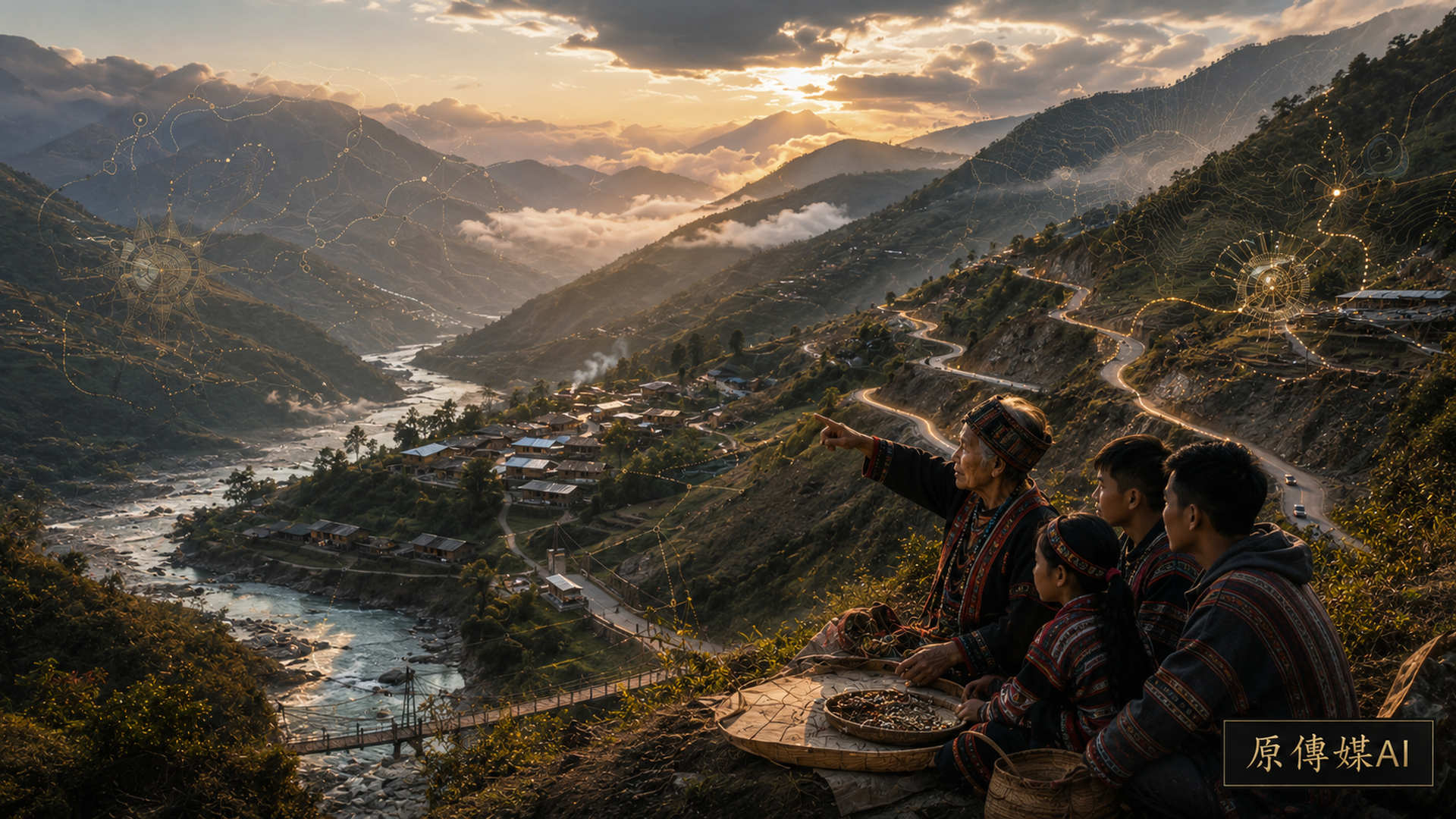
Navigation software is often most confident when it calmly announces, “You have arrived at your destination.” Yet for many Indigenous place names, reaching a coordinate is a long way from arriving at a place. A place is not a point but a web of relationships: water sources, migration, ancestors, hunting grounds, plants, memories of disaster, the rhythms of language, boundaries of cultural restriction, and community protocols for use. A digital platform may put a place on the map while flattening it at the same time if it retains only one standardized, searchable spelling.
Place Names Are Knowledge Systems Embedded in Landscapes
Modern geographic information systems tend to treat a place name as a set of fields: name, coordinates, feature type, and administrative area. That structure is convenient for a database, but often inadequate to the place. One location may have names in several languages, forms used by different Indigenous communities, names inherited from different historical periods, or distinct terms for internal and public use.
The United Nations Group of Experts on Geographical Names (UNGEGN) has long connected place names with cultural heritage, language revitalization, and identity. A place name, then, is not a neutral data point that can be collected and uploaded without conditions. It is knowledge deeply embedded in community context. A system designed around a single, stable, standardized answer can easily compress layered knowledge of place into a version that is easy to search and neatly distorted.
The Efficiency of Commercial Navigation Can Conflict with Plural Knowledge
Commercial map platforms prioritize speed, consistency, and usability at scale. Those aims are not inherently wrong, but they tend to favor one name, a fixed spelling, simplified linguistic difference, and standardized classification. When Indigenous place names enter that framework, they may not disappear altogether. Instead, they survive in a form stripped of context: special characters vanish; long vowels and glottal stops are omitted; local pronunciation is overwritten by dominant-language spelling; several historical names collapse into one; or an Indigenous-language name is demoted to a parenthetical note.
These may look like minor changes, but they ripple through education, research, tourism, public services, and disaster response. Once a platform’s rendering is treated as the “standard,” AI assistants, search engines, administrative databases, and textbooks may reproduce it, automatically magnifying the error. The more convenient the digital system becomes, the more natural its inaccurate version can appear.
Pronunciation and Protocols Are Not Optional Extras
Many platforms assume that spelling a name correctly is enough to show respect for a place. That assumption centers an outsider’s needs. In many languages, pronunciation, stress, tone, and rhythm are themselves forms of knowledge. A name preserved only as text may not be preserved in full. Practical cases considered by UNGEGN have highlighted Indigenous-language audio in place-name databases as an important step from making names visible to making them intelligible on their own terms.
Audio data, however, raises its own governance questions. Whose pronunciation is recorded? How are differences between generations represented? Can several dialect forms coexist? Was the recording made with consent? May a platform turn the audio into training data for speech models? Without answers, digital preservation can become a new mode of extraction rather than an act of co-governance.
Sensitive Places Require More Than Open-or-Closed Access
Indigenous place names may carry far more than geographic information. They can be connected to ceremonial sites, burial grounds, harvesting areas, sacred landscapes, traditional routes, or sensitive ecosystems. Publishing precise coordinates and detailed descriptions without distinction can intensify tourism pressure, enable commercial appropriation, expose ecosystems to damaging collection, or turn knowledge that should remain restricted into general-interest content.
UNGEGN’s guidance on place-name data modelling also stresses the importance of local acceptance regarding discoverability and the scope of publication. Responsible governance therefore needs more than the crude choice between “public” and “not public.” It should support tiers of access, authorization, annotation, and contextual explanation. A digitization program intent on listing everything can easily put convenience ahead of rights.
Local Contexts Shows That Governance Is About Community Authority
Local Contexts offers TK Labels and BC Labels as a way to express cultural sensitivity, conditions of use, community recognition, and responsibilities for feedback—even where conventional copyright law cannot fully articulate Indigenous data rights. Their importance lies in moving the question beyond whether data may be used to how it should be used, by whom, and under what conditions.
If map platforms supported such labels, navigation and place-name data would not have to fit a single open-licensing model. This would not obstruct the circulation of data; it would give that circulation a basic framework of cultural responsibility. Openness without governance often does little more than make knowledge easier for outsiders to appropriate.
The Power to Correct a Map Reveals Who Holds Authority
Many Indigenous communities have encountered misspelled names, misplaced locations, mistranslations, or inaccurate historical notes on digital platforms. Correcting them may require navigating cumbersome appeals built around standardized external criteria. Platforms ask for “official documents” and “authoritative sources,” even though oral tradition, community consensus, language specialists, and elders may be the most authoritative sources for an Indigenous place name. A platform unable to recognize those forms of evidence excludes local knowledge through a single institutional vocabulary.
Fair map governance requires more than an edit button. It calls for sustained co-governance: community proposals, version histories, pronunciation updates, multiple names displayed together, sensitivity labels, dispute-resolution procedures, and feedback loops. That may sound complex, but it is more honest than allowing a platform to decide silently which name is “best for search.”
Place-Name Standards Must Support Languages, Variants, and Context
UNGEGN’s guidance on data modelling and standards makes clear that a place-name record should not be reduced to one name field. A useful model must accommodate multiple languages, writing systems, and names, as well as sources, status, time, and lifecycle information. This is not a minor technical refinement; it is the minimum needed to represent the complexity of actual places. A mature digital foundation for Indigenous place names in Taiwan would include pronunciation, language tags, community and official variants, disclosure levels, source communities, revision records, and authorization information. Otherwise, navigation, education, disaster response, tourism, and AI systems will continue reproducing flaws in incomplete data.
Public Services and Disaster Response Need Local Usage
Accuracy in place names is not merely a question of cultural aesthetics. Multiple names matter in mountain transport, medical evacuation, rescue positioning, and local public services. Official road names, names commonly used in a settlement, traditional landscape names, and terms used by different generations may all coexist. If an emergency interface displays only an externally standardized name, residents may not recognize it immediately. If people from outside know only the platform name, they too may become disoriented precisely when shared understanding matters most.
Cultural data sovereignty therefore does not stand in opposition to public safety. It is one condition of a mature public-safety system. Public services become more accurate when place-name data reflects how people actually refer to places.
A Map Can Guide, but It Cannot Speak for a Place
Digital maps make remote landscapes easier to see and bring many places into wider search for the first time. That can be valuable, provided platforms understand that they are not the places they depict. They can help someone arrive, but they do not thereby acquire the authority to name or interpret.
Before an Indigenous place name is added to a platform, the first question should not be how quickly it can go live. The prior questions concern consent, provenance, pronunciation, sensitivity, authorization, and correction. Without those safeguards, a platform may guide people to the right coordinates while pulling the place away from its own language and framework of rights. This is a recurring digital-age mistake: believing that we have preserved a place when we have merely made a convenient version of it.
Supplementary Observation: Platforms Need Co-Governance, Not One-Time Collection
When a map platform collects information once, publishes it, and then permits unrestricted citation, transcription, and redistribution, an inaccurate Indigenous place name can harden into yet another fixed form. A better system would give Indigenous communities continuing rights of revision, retain the history of name variants, support updated pronunciation recordings, tier access to sensitive information, and provide authorization workflows for public-service uses. Data sovereignty is not simply a demand to close data. It means that the communities holding the knowledge and its context share authority over how the data is used, how openly it is released, and how feedback returns. Digitization without governance makes a name easier to find but harder to respect.
Sources retained from the Chinese original
AI use and content-safety disclosure
AI assisted with data organization, structural drafting, and prose refinement. Human editors set the perspective and fact-checking direction.