There Are No Roads at Sea, Yet the Body Knows Where to Go: Marshallese Wave Navigation Challenging Satellite and Chart Confidence
Original Chinese title: 海上沒有路,身體卻知道往哪裡走:馬紹爾群島浪湧導航如何挑戰衛星與海圖的自信
Drawing on Marshallese wave navigation, stick charts, and wave physics, this article examines how maritime spatial cognition belongs at once to the body, ocean, memory, and scientific measurement.
Lawrence Lee
Technology journalist, science fiction critic, space science educator.
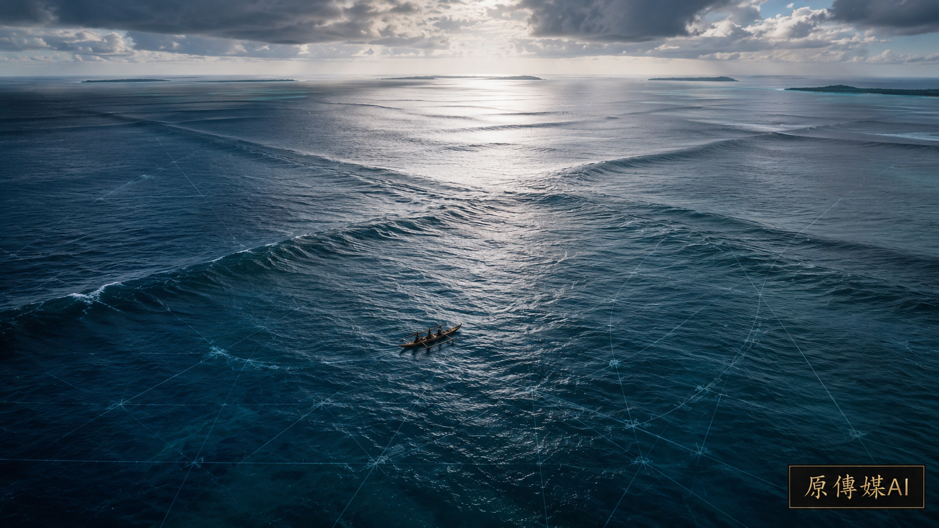
GPS makes navigation seem like a disembodied act: input the destination, watch a moving dot on screen, trust that the display is always more reliable than the sea. Yet in traditional Marshallese maritime knowledge, the route is not a polyline on a screen but wave direction felt through the body as the hull rises and falls, waves intersecting, reflecting, and being altered by islands. Navigation is not merely calculating from A to B; it is learning to read the sea, and in that reading, understanding how one’s own position co-locates with the world.
Stick Charts Are Not a ‘Primitive Google Maps’
The object most loved for showcasing Marshallese navigational wisdom is the stick chart, constructed from coconut midribs, shells, and thin strips. They appear as abstract sculptures and are often simplified in tourism and popular science texts to ancient Pacific maps. But the original Oceanography paper PDF|Wave Navigation in the Marshall Islands indicates that stick charts function more as memory and wave-relationship training tools than as on-board reference charts for immediate consultation. They do not depict coastlines; they encode how wave systems are altered by islands and how different islands relate to one another through sea conditions.
In other words, this knowledge asks first not ‘where is the place’ but ‘how does the sea move’. That is precisely a question modern navigation rarely confronts directly. Satellites and charts excel at fixing position; traditional navigation excels at treating flow as perceptible order.
There Are No Roads at Sea, Yet There Is Perceptible Texture
Marshallese navigational narratives frequently invoke terms related to wave swells, ridges, island refraction, and intersection. Islands are not merely points on a map; they alter the trajectory of large-scale waves. Experienced mariners identify regularities formed when different wave systems meet through accumulated bodily sensation, hull movement, visual field, and time. To outsiders, the sea surface seems endlessly repetitive; to navigators, those undulations read like sentences.
What is most fascinating here is not romanticizing that ‘ancestors knew everything’, but acknowledging that the body can serve as a high-precision sensor. Modern science prizes instrument calibration yet often forgets that human bodies, through rigorous training, become highly specialized interpretive tools. This is not anti-science; it restores the word ‘observation’ to humanity’s oldest craft.
Wave Physics Can Explain Part of It, But Not All
To take this knowledge seriously, outsiders must enter dialogue rather than co-opting it as fable. The aforementioned Oceanography article attempts to align Marshallese navigational concepts with wave buoy data, satellite imagery, and wave physics models. Researchers found that some traditional descriptions of wave direction and island influence can be understood via refraction, diffraction, and interference; yet other concepts remain incompletely reconstructed by the models.
This is precisely where Two-Eyed Seeing holds its most valuable position: not ‘science finally proves ancestors were right’, nor ‘lack of proof means tradition is myth’, but forcing both sides to articulate their boundaries. Wave models excel at quantification, simulation, and repeatability; traditional navigation excels at long-term embodied training and contextual interpretation. When they meet, the best outcome is not one swallowing the other but each approaching a more precise description.
Satellite Navigation Makes Things Easier, Possibly Dumber
Modern maritime navigation heavily relies on electronic systems—a massive technological advance. Yet technology’s cost often entails abandoning certain capacities. When crew members trust only screen coordinates without understanding how waves alter direction, wind shifts, or why seabirds deviate, they resemble urbanites who depend solely on smartphone maps while losing all sense of terrain, orientation, and distance. That is not inevitable civilization; it is perceptual outsourcing.
In this sense, Marshallese navigational knowledge is not merely a cultural preservation issue but poses a contemporary technological question: if a system becomes increasingly accurate yet renders users less attuned to their environment, does that make them smarter? Today’s AI navigation, unmanned vessels, and smart ocean systems that ignore Oceanic cultural knowledge may advance on data while regressing in understanding.
Stick Charts and Embodied Cognition Are Treasures for Science Education
This topic matters also because it can liberate science education from the habit of a single epistemic entry point. Navigation, waves, and positioning naturally encompass physics, geography, history, culture, and bodily training. Students who learn only wavelength, frequency, and current formulas without considering how humans built high-reliability navigation without metal instruments flatten the world.
Indigenous Oceanic knowledge offers not a story awaiting modern curriculum beautification but an alternative cognitive architecture: starting from relations rather than abstract coordinates; from continuous perception rather than one-off measurement; from apprenticeship training rather than single-reading manuals.
True Inspiration for Machine and Sensor Design
To bring this knowledge into contemporary technical dialogue, the most interesting direction lies not in retrograde imitation but in redesign. Must unmanned vessels rely solely on GPS, IMU, and chart overlays? Can they incorporate dynamic perception of multi-directional wave fields, hull sway patterns, and island wave interference as inspired by traditional navigation? Should maritime search-and-rescue systems integrate finer-grained local swell knowledge rather than only standardized routes?
These questions imply that traditional knowledge is not merely museum preservation but can intervene in next-generation machine sensing design. Of course, the premise must not drain knowledge into engineer-friendly parameters. Genuine Two-Eyed Seeing collaboration must retain cultural context and knowledge holder authority; otherwise it becomes another form of technical appropriation.
Ocean Knowledge Should Not Be Romanticized Nor Underestimated
Discussing Indigenous Oceanic knowledge risks two pitfalls: romanticization, casting navigators as mysterious geniuses; or underestimation, treating the technology solely as historical heritage. Rather, it resembles a high-intensity professional training requiring memory, simulation, practice, error correction, discipline, and intergenerational transmission. Such knowledge systems do not need sanctification; they are already awe-inspiring.
For today’s us, it offers more than Pacific stories—a rare modern reminder: the world does not always have to be drawn into maps before we understand it; sometimes one must first let the body enter the environment for knowledge to emerge. There are no roads at sea, yet the body may know earlier than screens where to go.
Supplementary Observation: Embedding Perceptual Capacity in Technical Design
If wave navigation is reduced merely to data awaiting digitization, collaboration easily veers off course from inception. Navigators do not judge sea conditions via isolated parameters but through relational feedback of hull response, intersecting wave systems, wind direction, travel time, and island position. Engineering teams seeking inspiration should first record how judgments generate rather than immediately translating local vocabulary into sensor fields; this avoids models appearing precise while losing the contextual basis of knowledge.
Training methods also merit study as research objects. Stick charts, oral transmission, demonstration, and sea practice each serve distinct functions: some aid memory, others correct bodily perception, still others are only articulated during shared voyages. If educational design retains only displayable artifacts, students may remember chart shapes without grasping how errors are corrected. A fuller pedagogy should simultaneously present observation, prediction, practice, and feedback.
Such collaboration requires clear rights boundaries: which terms can be public, which navigational experiences must remain with knowledge holders, who maintains models and materials—all to be agreed before data collection. Technology can assist preservation and comparison but does not thereby acquire authority to replace navigator testimony. True complementarity is not compressing two knowledge systems into one map but enabling users to know under what conditions each evidence type is reliable and where it demands stopping to ask.
Sources retained from the Chinese original
AI use and content-safety disclosure
This article was assisted by AI for data organization, structural drafting, and sentence polishing; human editors set viewpoint and fact-checking direction