Turning Clouds, Wind, Moon Phases, and Bodily Sensation into Sailing Warnings: Who Owns the Forecast Rules When Indigenous Knowledge Enters a Fishing-Village Weather Platform?
Original Chinese title: 把雲、風、月相與身體感變成出海警示:原住民族知識進入漁村天氣平台,誰擁有預報規則?
A 2026 Lake Victoria study converted seventeen local weather indicators used by fishers into a fuzzy-logic forecast. Digitization may improve access, but it also raises new questions about knowledge rights, accuracy, and responsibility.
山海資料庫筆記
Consultant: 高德生
山海資料庫筆記; consulting advisor 高德生, a Tsou ceremonial-ecology specialist, hunter-school and cultural-history worker, and author of The Tsou Book of Plants and Animals.
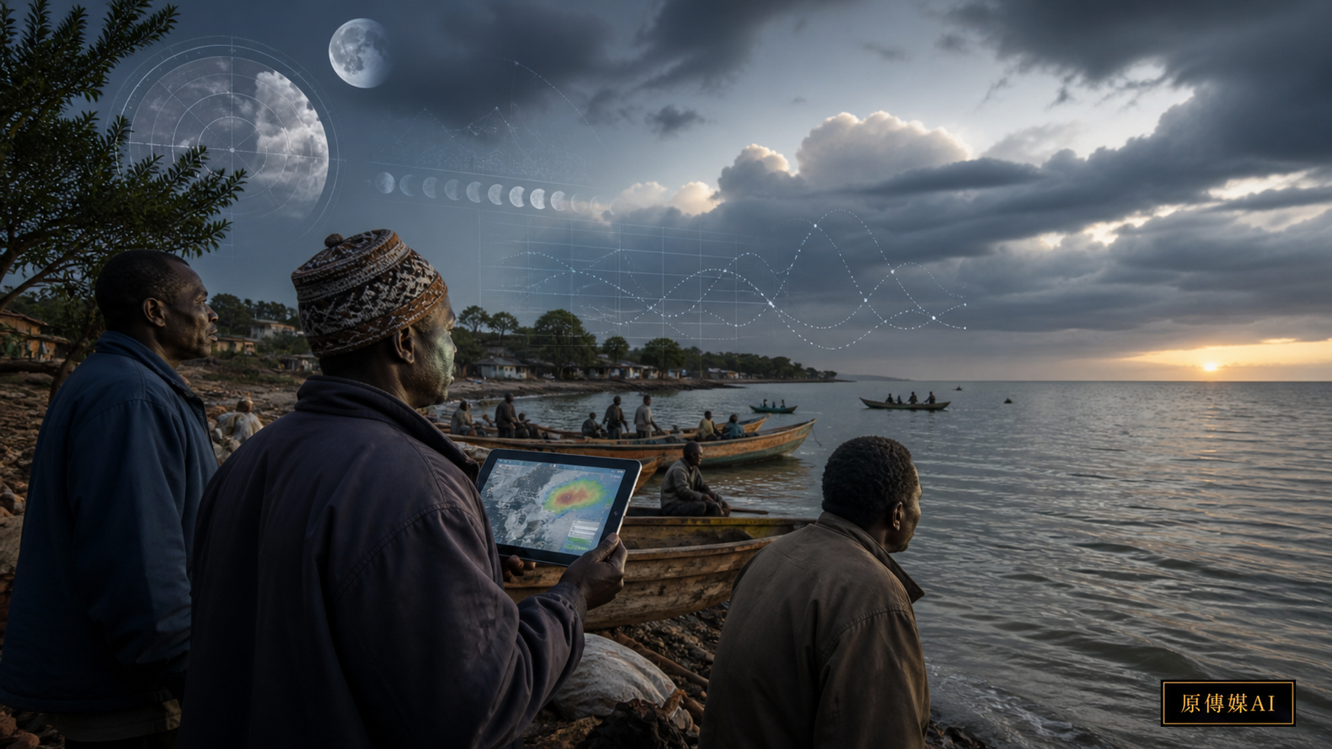
Looking at clouds, sensing the wind, and observing moon phases and animal behavior before setting out are not superstition in many fishing communities. They are forms of risk judgment accumulated over time. Climate change is making established seasonal patterns less stable, while modern weather services may not reach small-scale fishers in local languages, at a sufficiently fine spatial scale, or at the right time. When both knowledge systems are incomplete, the most useful course is not to eliminate one but to build a forecast service that both can examine.
A Lake Victoria study published in 2026 collected seventeen Indigenous-knowledge indicators: wind cycles, moon phases, cumulonimbus clouds, fog and dew, lightning, leaf changes, bird and frog activity, insect appearance, and bodily sensations at night. Researchers used a random forest to help identify important indicators and then built a Mamdani-type fuzzy-logic platform. The Cleaner and Responsible Consumption study of an Indigenous weather-forecast platform at Lake Victoria identifies cumulonimbus clouds, wind cycles, moon phases, and bodily sensation among the principal indicators.
The study classified forecasts as normal, poor, or high risk and compared them with observations from a nearby automatic weather station. After rule cleaning, it reported accuracy of about 63.5 percent. That figure should neither be dismissed as useless nor promoted as sufficient by itself to decide whether to sail. Sample period, seasonal distribution, distance from the station, semantic differences among local indicators, and the proportion of dangerous events all affect performance. In a life-safety setting, missing one high-risk event may matter more than issuing several conservative warnings.
More precisely, formal validation covered only fifty-two days: the system was correct on thirty-three and wrong on nineteen. Performance varied sharply by task. Fishing-activity classification reached 63.5 percent, rainfall about 53.85 percent, temperature about 55.77 percent, and wind speed only about 32.69 percent. Wind-speed performance was weak partly because local experts more readily described wind direction and type, while the automatic station recorded numerical speed. The two languages do not naturally map one-to-one. The validation results of the Lake Victoria fuzzy-logic study are therefore better understood as a short-term feasibility test than as a mature maritime-safety product.
This gap also shows why “accuracy” should not be reduced to one total. A platform should publish recall, false-alarm, and missed-event rates separately for normal, poor, and high-risk conditions, and explain the seasons and times in which errors occurred. If most observations come from calm weather, a model can obtain an attractive overall score by repeatedly predicting normal conditions while failing in actual danger. For fishers, the crucial measures are whether high risk is detected in time, how much warning is provided, and whether a safe alternative exists—not the average score alone.
The study initially organized seventy-seven fuzzy rules. Review found exact duplicates, rules subsumed by others, conflicting conclusions about lake conditions, and inconsistent outputs; cleaning left sixty-two rules. This work matters more than calling the model artificial intelligence, because local experts can point to each rule and explain where it fails seasonal experience. A fuzzy system gains credibility from being readable, disputable, and editable. If an upgrade hides the rules inside an opaque model, the community loses the ability to inspect errors.
The role of machine learning must also be clear. The random forest mainly selected influential features from the seventeen indicators; everyday lake-condition judgments still came from Mamdani fuzzy inference. Marketing the entire system as a black-box AI forecast would conceal the work of knowledge holders who defined meanings and rules, while leading users to think the model discovered cultural significance by itself. Public documentation should distinguish data collection, feature selection, rule construction, weather-station comparison, and final publication, and name responsibility at every layer.
Fuzzy logic can convert imprecise statements into computable rules—wind becoming rather strong, clouds building quickly, or an unusual bodily sensation at night—without pretending that every local observation has one numerical threshold. It also allows rules to be listed, discussed, and revised. Yet as soon as local knowledge enters a platform, new power questions arise. Who decides which indicators matter? Who may see all the rules? May a developer commercialize them elsewhere? Can the community withdraw them?
The WMO Task Team on Indigenous and Local Knowledge for climate services emphasizes knowledge integration and co-production, not the treatment of local knowledge as a free dataset. In Taiwan, a first step would be for each community to define which observations may or may not be public and to preserve Indigenous-language names, seasonal context, knowledge holders, and use restrictions together. A database without governance information leaves only decontextualized feature columns.
The second step is two-way calibration with official observation. Local knowledge can add microtopography, nearshore wind, currents, cloud forms, and sea-state detail; radar, buoys, and numerical forecasts provide large-scale systems and continuous measurement. When they disagree, one should not automatically overwrite the other. The service should record the season, place, and time scale of the disagreement and return it to community and professional teams for joint revision. The inconsistency itself may reveal a service blind spot.
The third step is translating forecasts into actionable risk language. A percentage alone may not help a fisher decide to delay, change route, or return. The WMO's Weather Field School for Fishermen combines marine weather, local observation, and hands-on training, showing that a platform still needs face-to-face interpretation and drills. A real service should state the hazard, expected time, affected waters, recommended action, and validity period.
A local-language interface is not simply an official forecast translated word for word. Names for clouds, winds, and animal behavior may encode season, place, and action. Mapping them only to fixed numbers strips away relational context. Designers should preserve who explained each indicator, where and when it applies, and what exceptions exist, while allowing different local descriptions of the same phenomenon. Voice, images, radio, and text messages may carry warnings, but knowledge holders must still decide whether the underlying knowledge is public.
Forecast responsibility must be rehearsed before launch. Historical cases and simulated weather can test who decides when local indicators show high risk but the official forecast does not, how to notify people if both warn but communications fail, how to update vessels already at sea, and who bears the cost of returning after a false alarm. Each drill should record delivery time, comprehension, action, and communication dead zones, then revise rules and publication procedures instead of merely checking whether a website displayed a result.
Knowledge rights include versioning and withdrawal. When an Elder or fisher changes a rule, the platform should record who changed it, when, and on what seasonal experience. An outside researcher or company seeking to move the rule elsewhere must obtain consent again. Communities should be able to pause an indicator, restrict commercial use, or require removal of content that should not be public. The WMO's direction of co-producing services with Indigenous and local knowledge becomes more than formal participation only when these rights can be exercised.
A Taiwanese pilot must not treat different peoples and waters as one dataset. The east coast, offshore islands, estuaries, and lakes differ in winds, currents, terrain, and fishing practices, and their observations have distinct languages and sharing boundaries. One willing community could first define a small set of high-risk scenarios, collect data across at least one complete season, and interpret them jointly with the weather agency. Evaluation should measure not only accuracy but reduced risky departures, better return decisions, increased use of official services, and genuine local authority to alter or stop the system.
For Indigenous and island fisheries in Taiwan, a practical pilot could start with one season, one port, and a few high-risk scenarios. Fishers would record their pre-departure judgment, the official forecast, actual sea conditions, and final decision, then compare which signals provide the earliest indication of wind, waves, thunderstorms, or poor visibility. Both false alarms and missed events must be preserved, and local participants should decide which kind of error is more acceptable instead of pursuing one attractive average accuracy score.
A platform cannot push responsibility back onto individuals. Even a high-risk display may fail to create safety if the port lacks immediate broadcasting, communication dead zones remain, lifesaving equipment is inadequate, or no one bears the cost of returning. Local government, weather agencies, fisheries associations, and communities should specify in advance who publishes and updates warnings, who maintains equipment and drills, and which backup process applies when the system is down.
The study opens more than a method for using AI to preserve traditional knowledge. It asks two incomplete forecast systems to become accountable to one another. Local knowledge should not be romanticized, and scientific forecasts should not be assumed infallible. Both require traceable validation, explicit uncertainty, and revocable data governance. Digitization avoids becoming another form of knowledge extraction only when fishers and communities can jointly revise the rules, retain knowledge rights, and gain tangible safety benefits.
Sources and Further Reading
- Cleaner and Responsible Consumption | Lake Victoria Indigenous weather-forecast platform
- WMO | Task Team on Indigenous and Local Knowledge for climate services
- WMO | Weather Field School for Fishermen
Yuan Media AI | Continue Asking from Your Role
This article provides four role-based entry points, each with five questions, for twenty pre-generated role-based follow-ups. The interface displays the relevant questions and answers for each role. Every answer retains embedded source links, and no model is called live in the browser.
AI use and content-safety disclosure
This English version is an AI-assisted translation based on public 2026 research and WMO materials. The international case cannot be treated as equivalent to Indigenous contexts in Taiwan; local communities and professional agencies must jointly verify any implementation.