Sea Ice Models Missed What Hunters Have Long Known: Two-Eyed Seeing Across the Arctic Cryosphere
Original Chinese title: 海冰模型竟然漏看了獵人早就知道的事
When global climate numerical models predict polar sea ice loss on macro scales, grid resolutions systematically overlook the micro-scale ice conditions hunters rely on for survival. Examining Inuit ice vocabulary, Sikuviruk and landfast ice dynamics, and the SIKU data platform, this feature explores how traditional ecological knowledge rectifies satellite blind spots and offers local insights for extreme climate monitoring in Taiwan mountains.
阿將伊崮喜瀾
阿將伊崮喜瀾 focuses on Indigenous ecological wisdom, environmental remote sensing, and cross-cultural knowledge construction, committed to bridging generations of local observations with modern climate models through two-way dialogue.
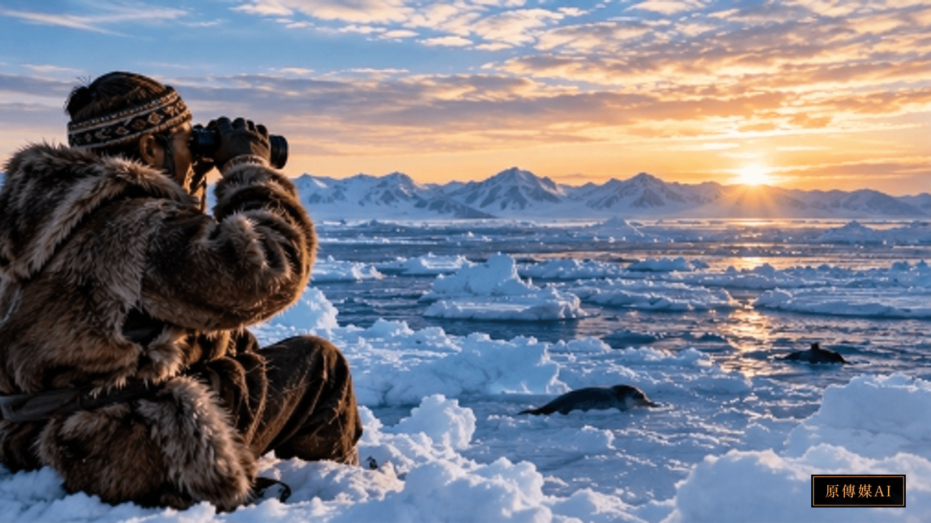
The Eye of the Satellite and the Eye of the Hunter: Collision of Two Spatial Scales
In contemporary climate change research, the thaw of Arctic sea ice is considered the most sensitive thermometer of planetary warming. Day and night, supercomputers calculate the complex equations of the Coupled Model Intercomparison Project (CMIP6). Synthetic aperture radar satellites and microwave altimeters pierce dense clouds to render sweeping panoramas of ice thickness distributions and extent retreat trends spanning thousands of kilometers. Yet behind this multibillion-dollar digital macroeconomic gaze, a foundational scientific blind spot persists: when satellite sensors perform spatial averaging over grid cells of 25 kilometers or larger, they flatten out ice fissures, localized current scour, sub-ice salinity gradients, and the formation of thin ice on the leeward sides of micro-topography. For climatologists seated in heated academic offices, this represents merely an acceptable statistical error margin; but for Inuit hunters stepping onto the ice pack to hunt ringed seals and walruses, that micro-scale discrepancy of tens of meters is frequently the dividing line between life and death.
Inuit communities have lived and thrived across the polar ice sheets for millennia. Deep within their culture, ice is never regarded as mere frozen water, but as a living landscape with its own life cycle, continually breathing and deforming. Across Inuit languages, dozens of distinct terms describe sea ice morphology, mechanical strength, crystal texture, and relative hazard. For instance, newly formed thin saline ice that cannot yet bear human weight is known as *Sikuviruk*; landfast ice firmly frozen to shoreward rocky reefs is called *Tuvaq*; and non-freezing open water areas repeatedly hollowed out within the ice pack by wind waves and underwater warm currents are termed polynyas. These precise concepts are not poetic literary metaphors, but a rigorous, empirically testable, and highly adaptive experiential algorithm.
When a Western numerical climate model predicts that a certain marine sector has achieved an eighty-five percent sea ice concentration and classifies it as a stable ice field, local hunters can instantly determine whether the underside has been hollowed out by unseen submarine upwelling simply from the elastic deflection transmitted through caribou-skin boots, the twitching frequencies of sled dog ears, or the dull acoustic resonance of a harpoon (*Unaaq*) striking the surface. That hidden decay could cause sudden and fatal offshore fracturing. This knowledge system—deeply intertwining sensory intuition, generational oral memory, and micro-physical feedback loops—is directing the most serious interrogation toward modern environmental science: are we truly seeking to understand the living planet, or are we worshiping the simplified illusions of our own computational simulations?
Blind Spots in the Numerical Grid: What Do Climate Models Overlook?
To understand the rupture between climate models and Indigenous knowledge, one must inspect the physical building blocks of contemporary atmosphere-ocean general circulation models. Predominant polar sea ice dynamic models rest primarily upon thermodynamic phase change equations and fluid mechanics rheology. These numerical frameworks calculate incoming solar irradiance, ice surface albedo, sea surface sensible and latent heat fluxes, and large-scale Coriolis accelerations, solving differential equations across discrete grid nodes using finite difference or finite volume techniques. While this top-down mathematical abstraction demonstrates formidable explanatory power over decadal pan-Arctic sea ice volume decline, its congenital limitation lies in its inability to resolve coastal boundary micro-environments.
The first major shortfall is the distortion of localized hydrological dynamics. Nearshore ice conditions in the Arctic depend intimately upon fine-grained interactions between submarine bathymetry, fjord tidal ranges, and estuarine sediment outflow. Across numerous Inuit hunting grounds, submerged reefs trigger vigorous vertical eddies that funnel relatively warm, high-salinity deep water directly against the lower boundary of the ice pack, carving out hollow cavities invisible from the surface. Satellite microwave altimeters, constrained by footprint dimensions, can record only the average elevation of the surrounding solid ice, tagging the sector on official charts as safe, thick ice. Yet hunters, by observing steam rising from frost smoke and the acute diving patterns of seabirds, can immediately pinpoint hazardous upwelling conduits.
The second critical issue is the unpredictability of internal ice stress and micro-fissure propagation. Within a few hours of an abrupt wind shift, several square kilometers of the ice canopy can experience catastrophic shear fracturing driven by long-period swell interference hundreds of kilometers away, opening sudden flaw leads. Conventional numerical modeling cannot simulate these brittle fracture chain reactions in real time at localized nodes. Elders, however, by listening to the deep low-frequency groaning within the ice sheet and reading the *Water sky*—the dark reflection of open water cast upon the undersides of low clouds along the horizon—can anticipate danger hours in advance, steering dog sled parties safely back to solid *Tuvaq* shorefast ice.
A deeper blind spot stems from the severance of phenological indicators. Modern physical models treat sea ice as an inanimate rigid body, overlooking its ecological complexity as the foundational matrix of the polar marine trophic web. The density of seal breathing holes (*Aglu*), sub-ice algal bloom discoloration, and the meandering tracks of Arctic foxes serve as direct physiological indicators of ice light penetration, dissolved oxygen, and structural integrity. Climatologists who exclude these living signals from their observation matrices and fixate solely on geometric thickness will never decipher how the cryosphere non-linearly responds to climate volatility.
The SIKU Platform and Data Sovereignty: Rooting Ancient Knowledge in the Digital Era
Confronting this chasm between mainstream scientific research and local survival, Arctic Indigenous peoples have chosen not to reject technology, but to lead a profound movement of technological re-domestication. Co-developed by Canadian Inuit communities and the Arctic Eider Society, the SIKU Indigenous Knowledge Social Network and Environmental Monitoring Platform stands as a premier flagship of this epistemic mobilization. Named after the Inuktitut word for sea ice, SIKU is not simply a mobile app for logging wildlife and ice conditions; it is a full digital architecture established upon the bedrock principles of Indigenous Data Sovereignty.
On the SIKU platform, Inuit hunters and youth during routine patrols, subsistence hunting, or trail travel deploy built-in Inuit Ontology tagging structures to upload geotagged field photographs, hazard notices, and phenological observations. These tags directly adopt Indigenous terminology, precisely recording ice texture, brine expulsion stages, snow cover depths, and the behavioral patterns of keystone species such as ringed seals. Concurrently, the platform automatically overlays synthetic aperture radar imagery from the Canadian Space Agency RADARSAT Constellation Mission, high-resolution optical satellite passes, marine tide tables, and near-real-time weather radar. In this unified interactive map, bottom-up micro-scale ground observations and top-down remote sensing big data converge on equal footing.
The revolutionary significance of this system lies in overturning the extractive paradigm where Indigenous knowledge is harvested as free raw material for academic publications. Within SIKU, ownership, access permissions, and data licensing strictly adhere to the OCAP principles (Ownership, Control, Access, Possession) championed by the First Nations Information Governance Centre and the CARE principles (Collective Benefit, Authority to Control, Responsibility, Ethics) established by the Global Indigenous Data Alliance. Hunters retain sovereign control: they can publicly share hazardous ice alerts with all circumpolar communities to protect navigation safety, while locking sacred hunting coordinates, lineage genealogies, or sensitive ecological nesting sites into restricted nodes subject only to tribal internal review.
Crucially, SIKU institutionalizes a mechanism for two-way calibration. Academic university teams no longer arrive with paternalistic assumptions to verify whether elders' oral testimonies are true. Instead, they ingest hunter-annotated micro-cracks and melt hotspots into supercomputing clusters to refine boundary-layer turbulence parameters, dramatically improving the predictive fidelity of numerical models within fjords, straits, and coastal bays. Ancient oral experience is no longer treated as quaint folklore, but elevates to an indispensable, high-fidelity ground truth calibration baseline.
The Ethics of Two-Eyed Seeing: Parallel Complementarity, Not Subsumptive Assimilation
This profound dialogue across sea ice observation poses an existential philosophical challenge to global climate governance. For decades, Western positivist science has held universality, reproducibility, and decontextualization as the sole yardsticks of truth, drifting into an unexamined scientific chauvinism: only phenomena recorded by calibrated instruments and translated into partial differential equations are deemed objectively real, whereas Indigenous knowledge rooted in specific ancestral territories, kinship relations, and ceremonial ethics is marginalized as subjective anecdotal lore.
The concept of Two-Eyed Seeing (*Etuaptmumk*), articulated by Mi'kmaq Elder Albert Marshall, serves as the vital key to deconstructing this knowledge hierarchy. Two-Eyed Seeing teaches that we must learn to see from one eye with the strengths of Western scientific tools, standardizations, and macro-scale trends; from the other eye with the strengths of Indigenous traditional knowledge regarding micro-environments, ecological relationality, and intergenerational responsibilities; and use both eyes together for the benefit of all. This mandates that the scientific establishment must not commodify or fragment Indigenous knowledge—extracting only isolated data points that fit Western algorithms while discarding the underlying land ethics and spiritual commitments. Both knowledge traditions must stand firmly on their own ground, engaging in respectful parallel dialogue.
When climate modelers acknowledge the spatial limitations of numerical simulations and enter tribal elder councils with humility, science acquires genuine self-reflection. A hunter's survival algorithm did not emerge from thin air; it is the ultimate empirical crystallization forged through thousands of years of extreme stress-testing paid for in human lives. Integrating traditional ecological knowledge with contemporary remote sensing is not a compromise of scientific rigor, but a deeper reverence toward the living reality of nature.
From Arctic Ice Fields to Taiwan High Mountains: Local Lessons for Extreme Climate Monitoring
The two-way calibration between Arctic hunters and sea ice modeling provides profound cross-regional lessons for Taiwan, an island characterized by steep topography, subtropical typhoons, and acute climate sensitivity. Although Taiwan has no sea ice, its high-mountain Indigenous communities face equally violent climate disruptions: torrential typhoons triggering debris flows, compound landslides, catastrophic flash floods across unregulated mountain streams, and severe phenological disarray in montane ecosystems.
Historically, official disaster risk reduction in Taiwan has relied heavily upon top-down centralized monitoring systems. Soil and water conservation agencies and meteorological bureaus install automatic rain gauges, bore high-precision slope inclinometers into bedrock, and analyze Digital Elevation Models (DEM) alongside Interferometric Synthetic Aperture Radar (InSAR). Nevertheless, during severe typhoons or extreme short-duration downpours, instrument failures, sensor blind zones, and the inability to anticipate localized geological shear failures remain chronic vulnerabilities. Central alerts such as Yellow Warnings or Red Warnings are typically issued at the administrative township or large watershed level, failing to answer whether a specific ancestral fault line behind a tribal settlement is undergoing rapid creep.
Within Taiwan mountain territories, hunters and elders of the Atayal, Bunun, Tsou, and Paiwan peoples command an equally nuanced high-mountain sensory system. They recognize subtle acoustic variations when water-saturated rock strata are tapped; they understand that abnormal flocking and distress calls of birds such as the rufous-capped babbler or white-eared sibia signal impending slope instability; and they detect sudden turbidity combined with the odor of sulfuric mud in mountain creeks indicating that a landslide dam has formed upstream. These vital local indicators are the earliest warnings of catastrophic mudslides, yet because they are not digitized in real time, they are routinely overlooked in modern emergency command chains.
If Taiwan is to construct a resilient climate adaptation framework, it cannot stop at procuring foreign sensors or building centralized dashboards. Drawing inspiration from SIKU, Taiwan should establish Indigenous Two-Eyed Seeing environmental monitoring working groups. By equipping tribal youth and elders with autonomous digital tools, local communities can link generational landscape memories, phenological observations, and micro-watershed hydrology directly with Central Weather Administration radar echoes and Geological Survey LiDAR point clouds. Technology must become a lever that amplifies Indigenous stewardship rather than a bureaucratic constraint that displaces local wisdom.
Conclusion: Reclaiming the Capacity to Truly See on a Fractured Earth
Climate change is not a theoretical abstraction of future projections, but an urgent condition of lived survival. The gaze of an Inuit hunter standing on the edge of melting sea ice resonates deeply with the vigilance of Taiwan Indigenous forest guardians listening to mountain torrents amid severe storms. Both bear witness to humanity's oldest instinct: survival depends upon acute perception of the subtlest environmental shifts, never on the arrogance concealed behind computational numbers.
Contemporary technology grants us the planetary vantage point to look down from the heavens, yet it frequently deprives us of the humility to touch the soil beneath our feet. What sea ice models overlooked was never simply several square kilometers of thin ice, but the unbroken relational ethics binding humans and landscapes. Only when the macro-scanning eye of the satellite and the micro-sensing eye of the hunter clasp hands within the framework of Two-Eyed Seeing can human civilization navigate safely, humbly, and honorably through the escalating storms of our changing planet.
Sources and Further Reading
Role-Driven Inquiry
Yuan Media AI | Guided Questions by Role
Select a role first, then review the complete questions from that perspective; clicking a question will display Yuan Media AI’s response in real time.
Select a role
極地氣候模型與衛星遙測研究員
Examine the article's evidence, governance boundaries, data rights, and actionable steps from the perspective of a 極地氣候模型與衛星遙測研究員.
Choose a question
AI use and content-safety disclosure
AI assisted writing and translation. Source-supported facts, editorial interpretation, and implications for Taiwan are distinguished.