GPS Draws Lines, but Voyagers Read a Living Ocean
Original Chinese title: GPS畫的是線,航海者讀的卻是一整片活著的海
GPS flattens the vast ocean into geometric line segments on a screen, whereas Oceanic traditional wayfinders position their canoes at the center of the cosmos, sensing intersecting swells, rising and setting stars, and living biological signposts. From Mau Piailug's star compass framework and complex swell interference to Austronesian navigation cognition, this feature decodes dynamic cybernetics in non-instrument wayfinding and reawakens Taiwan Kuroshio maritime perception.
Lawrence Lee|英國里茲大學學者|原傳媒AI 科學與自然觀察作者、關注深海、太空與人類如何記錄難以抵達的世界
Lawrence Lee is a scholar at the University of Leeds and a science and nature observation writer for Yuan Media AI, following deep-sea exploration, outer space, and the human recording of remote realms.
Cartesian Coordinates Versus the Ontology of a Living Ocean
Across the screens of contemporary navigational instruments, the ocean has been thoroughly tamed into a homogeneous, passive, and sterile geometric container. Global Positioning System (GPS) receivers, intersecting radio timing signals from twenty-four medium Earth orbit atomic satellites, render crisp pixelated trajectories across liquid crystal displays. The origin is a latitude and longitude pair, the terminus is a waypoint coordinate, and the vessel is reduced to an infinitesimal cursor gliding without friction along an abstract vector. Within this Cartesian spatial ontology, seawater is simplified into hydrodynamic resistance, the atmosphere is stripped into a transparent medium transmitting radio waves, and the mighty Pacific Ocean is flattened into a static basemap to be zoomed and scrolled at will.
Yet millennia before European navigators ventured across open water with sextants, magnetic compasses, and marine chronometers, Austronesian voyagers had completed the most breathtaking maritime expansion in human history across one-third of the planetary surface. Spanning the Polynesian Triangle—bounded by Hawaiʻi, Rapa Nui (Easter Island), and Aotearoa (New Zealand)—this transoceanic diaspora was never a product of accidental drifting or blind luck. It was guided by a profound, systematic, and empirically rigorous science of non-instrument Wayfinding.
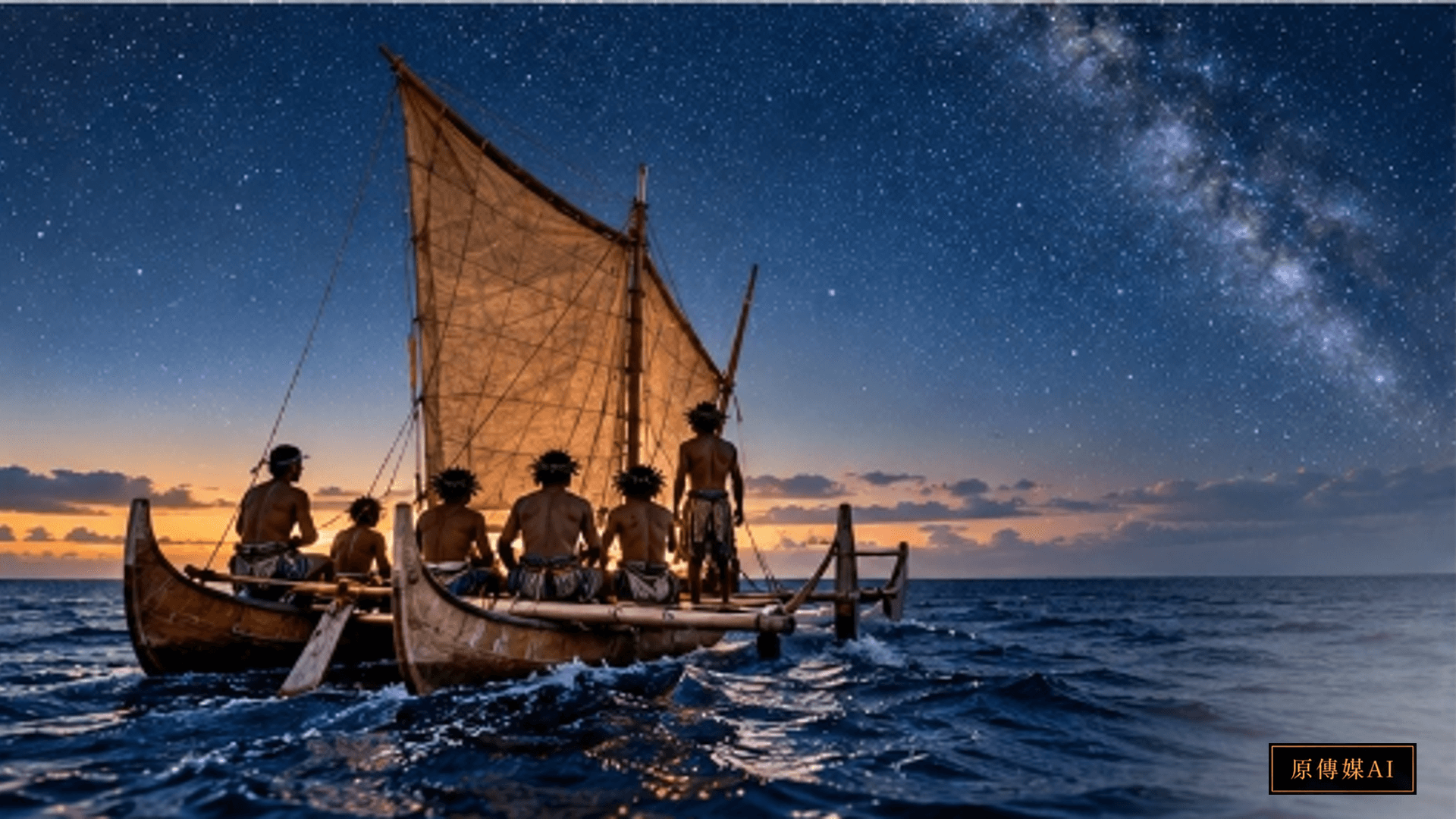
To legendary Micronesian master navigator Mau Piailug of Satawal and Hawaiian wayfinding pioneer Nainoa Thompson, the ocean was never a two-dimensional map, but a colossal, multidimensional, and ceaselessly breathing living system. Traditional voyagers do not fixate on lines on a display, for in traditional ontology, the vessel never moves; it is the surrounding universe that moves. The canoe rests tranquil and stationary beneath the celestial dome, while distant islands, carried by prevailing currents and rising and setting stars, march forward across the horizon to meet the hull.
The Star Compass as a Mental Construct: Externalizing Celestial Geometry
To comprehend non-instrument navigation, one must first dismantle romantic misconceptions that Indigenous navigators steered merely by vague sensory impressions. Oceanic wayfinding is an exacting discipline of mental geometry and real-time cybernetic feedback. Its central cognitive instrument is the Star Compass (*Kāpehu Whetū*), transmitted by Mau Piailug to the Polynesian Voyaging Society and subsequently formalized by Nainoa Thompson.
The Star Compass is not a physical tool forged of brass or bronze; it is an intricate mental construct etched directly into the navigator's memory. The 360-degree horizon is partitioned into thirty-two distinct directional houses (*Hale*). As dusk falls and stars emerge in the east, transit the meridian, and set in the west, every celestial body traces an unalterable trajectory across the vault of heaven.
The North Star (*Hōkūpaʻa*) anchors the celestial north, while the Southern Cross (*Hānaiakamalama*) aligns the southern axis. Near the equator, the three belt stars of Orion rise almost due east and set due west. Traditional navigators memorized the azimuths and seasonal trajectories of hundreds of stars from early childhood. Even beneath overcast skies, if a single star breaks briefly through cloud cover, a skilled navigator calculates its instantaneous altitude and spectral character to instantly reconstruct the entire thirty-two-house mental compass, holding the double-hulled canoe (*waʻa kaulua*, such as *Hōkūleʻa*) true to its heading.
Cognitive anthropologists identify this star compass as an extraordinary manifestation of Distributed Cognition. Rather than offloading spatial memory onto paper charts, environmental stimuli (starlight, angles) are integrated into real-time biological feedback loops whose operational resilience in dynamic seas surpasses early mechanical instrumentation.
Haptic Oceanography: Decoding Swell Refraction and Interference
If the starry heavens serve as the navigator's nocturnal chart, ocean swells provide the enduring tactile cipher whispered directly to the hull when stars are obscured. During oceanic voyages spanning thousands of nautical miles, the most hazardous ordeal is encountering days of squalls and dense cloud decks that erase the sun, moon, and constellations, while squall fronts distort local winds. Under these extreme conditions, the sole anchor keeping a vessel on course is the navigator's physical perception of deep-ocean swells.
Swells are fundamentally distinct from chaotic, localized wind chop. Deep-ocean swells are generated by powerful low-pressure systems thousands of kilometers away in the Antarctic Southern Ocean or subpolar North Pacific. Possessing wavelengths of hundreds of meters and periods of ten to twenty seconds, they carry immense momentum and transoceanic stability. Even when traversing multiple storm systems, deep swells march across open water with unyielding directionality.
Experienced navigators lie flat against the hull floor or suspend a hand above the waterline, shutting their eyes to isolate the vestibular system, spine, and proprioceptive muscle sensors. They feel the complex coupled pitch, roll, and yaw of the vessel as waves pass beneath. Across an apparently turbulent sea, three or four distinct swell trains often intersect simultaneously. A master wayfinder deconstructs these composite wave frequencies like an acoustic spectrum analyzer: identifying the trade wind swell from the east, the long-period polar swell from the southwest, and faint refracted waves rebounding from distant landmasses.
As a canoe nears an unseen island—even while still over a hundred nautical miles away—the terrestrial barrier blocks oncoming wave energy, casting a distinct wave shadow. Concurrently, wave trains diffract around coastal flanks and reflect back to sea, generating unique interference patterns with incoming swells. Sensing this subtle high-frequency chatter against the hull, a navigator confirms that an island lies below the horizon and triangulates its bearing from the angle of interference.
Ecological Signs and Living Networks: An Island's Expanded Screen
Modern navigation conceives of an island as an isolated geographic coordinate, vulnerable to being bypassed if a vessel strays by a few nautical miles. In Oceanic navigation, however, while an island's physical diameter may be only five kilometers, its living sensory radius spans over a hundred nautical miles. Wayfinding mastery centers upon interpreting dynamic ecological cues radiating from land, transforming open water into a vibrant navigational network.
Foremost among these indicators are the diurnal flights of seabirds. White terns (*Gygis alba*) and brown noddies (*Anous stolidus*) serve as dependable sentinels. Unable to rest on water overnight, they depart island nesting cliffs at dawn to hunt flying fish offshore and fly straight back to feed fledglings at dusk. Sighting a white tern in early morning indicates land lies in the opposite direction of its flight; spotting flocks streaming homeward at twilight allows navigators to lock their prow onto the birdline, ensuring landfall before dark.
Navigators also read drifting terrestrial foliage, the swimming headings of pelagic sea turtles, deep bioluminescent flashes excited by current shear (known in Polynesia as *Te lapa* or ocean lightning), and stationary greenish glows reflected onto cloud bases above shallow atoll lagoons (*cloud mapping*). The ocean reveals itself as an interconnected, resonant living ecology where humans never voyage in isolation, but as participants in a grand biotic web.
Reappraisal by Modern Science: Cybernetics and Distributed Cognition
Western academia long harbored skepticism toward Polynesian navigational capabilities. In the mid-twentieth century, New Zealand historian Andrew Sharp popularized the theory of accidental drift, asserting that Pacific island settlements resulted from canoes blown off course by storms rather than systematic navigation. This Eurocentric prejudice was definitively dismantled in 1976 when the Hawaiian voyaging canoe *Hōkūleʻa*, navigated entirely without instruments under Mau Piailug, crossed over 4,000 kilometers from Hawaiʻi to Tahiti in thirty-three days.
Over subsequent decades, systems cybernetics, human-factors engineering, and cognitive anthropology converged upon Oceanic wayfinding. Researchers discovered that Mau Piailug's mental architecture operates as an advanced Dynamic Feedback and Feedforward Control System. Instead of logging discrete coordinates, navigators maintain an adaptive filter resilient to environmental turbulence.
When cross-currents introduce leeway drift (*Set and Drift*), navigators do not fight to return to an arbitrary line; instead, they integrate star azimuths and swell headings to compute course-compensation angles, absorbing drift as an intrinsic dynamic variable. This ethos of ongoing self-calibration under high uncertainty mirrors principles in deep-space exploration, autonomous robotics, and quantum navigation. Ancient Indigenous science, polished by millennia of oceanic trials, offers profound lessons in resilience to modern societies over-reliant on fragile digital sensors.
Ocean Memories of Taiwan Kuroshio Navigation and Contemporary Reawakening
The renaissance of Oceanic wayfinding holds immediate cultural and ecological resonance for Taiwan, the ancestral homeland of the Austronesian diaspora. Taiwan's eastern coastline borders one of the world's most powerful ocean currents: the Kuroshio (Black Current). Sweeping northward at several knots, deep and indigo-blue, the Kuroshio was feared as a perilous black trench across centuries of Han settlement narratives.
Yet in the maritime cosmologies of Taiwan Indigenous peoples, such as the Tao (Yami) of Orchid Island (Lanyu) and the Pangcah (Amis), the ocean was never a barrier, but an oceanic highway connecting island worlds. The Tao craft the *Tatala* wooden canoe, reading the confluence of Kuroshio branches and coastal upwelling, coordinating fishing seasons, moon phases, and monsoon winds through ceremonial protocols; Amis paddling traditions and coastal observations similarly preserve delicate recognitions of inshore reefs, wave backwash, and tidal reversals.
Regrettably, modern marine governance in Taiwan long remained constrained by martial-law coastal closures and terrestrial mindsets, distancing island citizens from the open sea. Younger generations often navigate exclusively through blue dots on smartphone maps, becoming disoriented the instant digital connectivity falters.
The Oceanic voyaging renaissance demonstrates that we must recover the capacity to read the ocean. In promoting Taiwan's maritime identity and blue economy, marine science must engage in deep dialogue with Indigenous oral histories, wave-sensing systems, and canoe-building craftsmanship. Guiding youth aboard sailing canoes to experience swell dynamics and starry night skies will wash away continental insularity, revitalizing Taiwan's cultural pride as true children of the Pacific.
Conclusion: At Navigation's Destination, Rejoining the Web of Nature
GPS delivers calculated arrival times, yet it frequently strips away our capacity to perceive the living world along the journey. When travel is compressed into a precomputed shortest path, we lose the acute awareness demanded by the unknown, severing our intimate kinship with wind, waves, stars, and birds.
Oceanic wayfinders remind us that true voyaging does not conquer the world into a passive map; it turns our very bodies into resonators of planetary rhythms. Across that boundless blue expanse, no wave is extraneous, and no breeze is devoid of intelligence. When we silence digital screens, look up to the constellations, and listen to the pulse of the tides beneath our feet, we discover that the living ocean never left us—it has been waiting for modern humans to find our way back home.
Sources and Further Reading
Role-Driven Inquiry
Yuan Media AI | Guided Questions by Role
Select a role first, then review the complete questions from that perspective; clicking a question will display Yuan Media AI’s response in real time.
Select a role
海洋物理與衛星導航科技研究員
Examine the article's evidence, governance boundaries, data rights, and actionable steps from the perspective of a 海洋物理與衛星導航科技研究員.
Choose a question
AI use and content-safety disclosure
AI assisted writing and translation. Source-supported facts, editorial interpretation, and implications for Taiwan are distinguished.