Satellites Measure More Than Drought: How Pumping, Irrigation, and Dams Redraw Earth's Freshwater Ledger
Original Chinese title: 衛星量到的不只是乾旱:人類抽水、灌溉與蓄水工程如何重畫全球淡水帳本
Conventional hydrology frequently attributes diminishing river flows, falling aquifers, and shrinking lakes primarily to climate change and meteorological droughts. However, a landmark NASA study synthesizing over two decades of satellite gravimetry data from the GRACE and GRACE-FO missions demonstrates that direct human engineering—unregulated groundwater extraction, massive agricultural flood irrigation, and dam impoundment—has imprinted an anthropogenic signature on terrestrial water storage (TWS) that surpasses natural climate variability in major breadbaskets. Spanning 40 hotspot regions across every non-polar continent except Australia, these findings call for a fundamental reassessment of global freshwater budgeting. Co-authored by Shanhai Database and high school geography educator 李文驤, this article bridges orbital physics, spatial scale interpretation, and river basin governance to evaluate water allocation and watershed conservation.
山海資料庫
Co-authors: 李文驤
Shanhai Database focuses on urban landscapes, spatial data, and public governance; co-author 李文驤 is a geography teacher at Catholic Daren High School, assisting readers in understanding the interplay between infrastructure and natural conditions through geographic education, spatial relationships, and environmental contexts.
# Satellites Measure More Than Drought: How Pumping, Irrigation, and Dams Redraw Earth's Freshwater Ledger
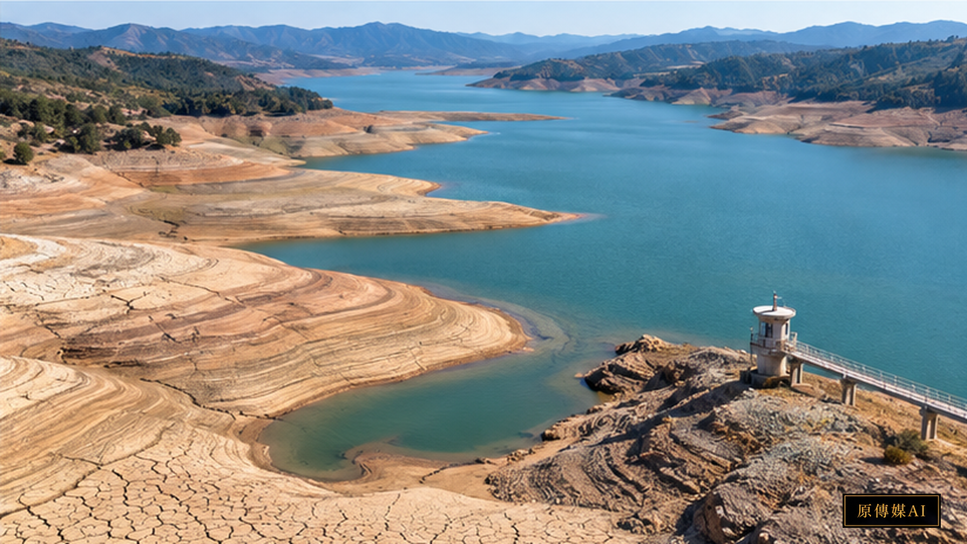
In contemporary public dialogues surrounding climate change, drying riverbeds, shrinking lake surfaces, and desiccated agricultural soils are routinely attributed by media headlines and policy discourses to extreme meteorological droughts. Attributing freshwater depletion entirely to natural disasters provides water resource managers with a convenient vocabulary of institutional absolution. However, landmark research released by the National Aeronautics and Space Administration (NASA) synthesizes over two decades of precision orbital satellite data to uncover an unavoidable truth: across major continental breadbaskets and river basins, direct human engineering—unregulated groundwater extraction, massive agricultural flood irrigation, and dam impoundment—has imprinted an anthropogenic signature on terrestrial freshwater storage that surpasses natural climate variability.
Combining satellite geodesy, orbital gravitational physics, and geospatial big data analytics, this study recalibrates the planetary freshwater ledger from 500 kilometers above the Earth. Co-authored by Shanhai Database—focusing on spatial data and public governance—and high school geography educator 李文驤, this article bridges satellite gravimetry principles, cartographic spatial scale interpretation, and river basin governance to look beneath superficial drought narratives and evaluate how infrastructure fundamentally reshapes hydrological landscapes.
Weighing Earth's Water from 500 Kilometers: The GRACE Mission Gravitational Scale
Understanding how orbital satellites detect concealed subsurface water dynamics requires examining how gravimetric missions weigh water mass from space. Conventional terrestrial hydrometric stations monitor river stage gauges or localized monitoring wells, struggling to assemble contiguous transboundary basin datasets and failing to evaluate deep regional aquifer storage. To resolve this global observational blind spot, NASA and the German Aerospace Center (DLR) developed the Gravity Recovery and Climate Experiment (GRACE) and its ongoing successor, GRACE-Follow On (GRACE-FO).
As detailed by the NASA Jet Propulsion Laboratory: GRACE and GRACE-FO Mission Data Portal, the GRACE mission deploys twin identical satellites in tandem orbit separated by approximately 220 kilometers. When the leading satellite traverses an area of greater localized mass—such as a heavily recharged river basin or mountain range—subtle gravitational anomalies pull it forward, marginally increasing inter-satellite distance. As the trailing satellite enters the same gravitational field, it experiences an identical pull, contracting the separation. Onboard microwave ranging systems and laser interferometers measure these minute distance fluctuations with sub-micrometer precision.
Because lithospheric mass remains relatively stable over short timescales, monthly shifts in localized gravity fields directly reflect the redistribution of water and ice. Through sophisticated geophysical inversion algorithms, researchers translate orbital distance variations into equivalent water thickness, calculating continuous changes in Terrestrial Water Storage (TWS)—encompassing surface lakes, rivers, snowpack, soil moisture, and deep groundwater aquifers.
Forty Global Anthropogenic Hotspots: Pumping Outpaces Climatic Fluctuation
Historically, a central challenge in hydrological science has been disentangling the extent to which terrestrial water storage losses stem from natural meteorological droughts versus direct human extraction and reservoir regulation.
A research team led by hydrologist Mary Michael O’Neill at NASA's Goddard Space Flight Center delivered a definitive answer in PNAS Research: Spatially refined satellite gravimetry captures human signatures in global terrestrial water storage trends. Analyzing continuous GRACE and GRACE-FO observations from April 2002 to November 2025, the researchers applied high-resolution spatial filtering to decompose terrestrial water storage trends into climatic components and human-associated variables.
According to the NASA Earth Observatory: The Human Fingerprint on Earth’s Water Cycle, the study identified 40 distinct hotspot regions across every non-polar continent except Australia where storage trends align strongly with human activities. Lead author O'Neill emphasized that across four major continental regions, anthropogenic variables—such as deep irrigation well density, reservoir impoundment, and land-use alteration—exhibited a stronger statistical correlation with storage trends than any meteorological climate variable.
The most acute manifestations occur in agricultural breadbaskets such as California's Central Valley and northern India's Indo-Gangetic Plain. In northern India, millions of electrified and diesel groundwater pumps extract deep fossil aquifers for continuous rice and wheat irrigation, causing groundwater reserves to decline significantly faster than previous international estimates indicated. Even during years with abundant monsoon rainfall, aquifer recharge fails to offset massive overdrafts. Elsewhere, large dam constructions stabilize local surface storage while severing natural downstream recharge pathways, disrupting basin-wide hydrological equilibrium.
Pedagogical Insights in Spatial Geography: Scale, Cartography, and Critical Reading
Co-author 李文驤, an experienced high school geography educator, provides essential pedagogical framing, connecting satellite geodetic discoveries to classroom spatial thinking. In geography education, students frequently mistake satellite remote sensing maps for objective, passive photographs of nature. Geographic literacy requires interrogating how maps embody spatial scale, spatial distribution, and human-environment interactions.
When projecting GRACE global water storage anomaly maps in the classroom, the vivid red (storage depletion) and blue (storage accumulation) gradients represent an unfolding political and economic history of environmental exploitation. Interpreting this cartography involves three dialectical layers:
First, understanding the invisibility of vertical space. Traditional two-dimensional maps highlight surface reservoirs, misleading the public into believing water supplies are secure as long as dams appear full. GRACE gravimetry reveals that Earth's primary freshwater reserves reside deep within subterranean aquifers. Pumping groundwater operates like withdrawing from an unmonitored bank account; when satellites weigh an aquifer losing mass, they expose the vertical unsustainability of surface agriculture.
Second, tracking horizontal transboundary spillover effects. Hydrological systems do not conform to national borders. Groundwater extraction across the Indus and Ganges basins directly impacts food security and geopolitical relations across India, Pakistan, and Bangladesh; water consumption in California's Central Valley is driven by national and global agro-industrial supply chains. Geospatial analysis trains students to link local irrigation pumps to international trade architectures.
Third, deconstructing causal narratives. Attributing water crises solely to drought obscures systemic institutional failures—subsidized electricity for pumping, unmetered borehole drilling, and the proliferation of water-intensive cash crops. Geographic education fosters critical cartographic analysis, layering geological maps, irrigation infrastructure data, and socioeconomic demographics to reveal structural realities behind satellite imagery.
Water Rights Justice and Indigenous Hydrological Stewardship
Reflecting on satellite observations through water policy highlights urgent questions of water rights justice. Conventional technocratic engineering treats water as an extractable commodity to be dammed, channeled through concrete canals, and privatized. This extractive framework has driven reservoir depletion, land subsidence, and ecosystem collapse worldwide.
In stark contrast stands the river kinship and hydrological stewardship cultivated by Indigenous peoples. Across Indigenous cosmologies, rivers and subterranean aquifers are living ancestral entities rather than passive resources. Seasonal stream flows, high-altitude cloud forest conservation, and springhead preservation are protected through customary protocols, kinship obligations, and ecological taboos.
Integrating Traditional Ecological Knowledge (TEK) into modern watershed governance is increasingly recognized as vital. In New Zealand, the Whanganui River has been granted legal personhood, with Māori custodians and government representatives serving as joint guardians. In North America, tribal nations lead dam removal initiatives along the Columbia River basin to restore wild salmon migration and natural hydrological rhythms. These models demonstrate that water governance must evolve from extractive accounting into a stewardship ethic that honors natural hydrological cycles.
Taiwan Watershed Vulnerabilities and Local Translation
Examining Taiwan through this planetary freshwater framework underscores critical local imperatives. Despite receiving average annual precipitation exceeding 2,500 millimeters—nearly three times the global average—Taiwan's steep topography, short rivers, and extreme seasonal rainfall concentration position the island as a water-stressed region under United Nations metrics.
Across western plains, such as the Choushui River alluvial fan in Changhua and Yunlin counties, decades of intensive groundwater overdraft for aquaculture, agriculture, and industrial development have triggered irreversible land subsidence, threatening structural alignments of high-speed rail corridors. Despite well-sealing policies, artificial recharge efforts remain hindered by underpriced water rates that fail to internalize ecological costs.
Concurrently, upstream mountain watersheds face severe governance gaps. Indigenous communities have historically stewarded headwater forests under stringent conservation restrictions, while captured water and hydroelectricity are piped to metropolitan and industrial zones without equitable economic return to source communities. Furthermore, extreme typhoons induce upstream landslides and reservoir siltation, jeopardizing regional water security.
Translating NASA's geodetic insights into local practice requires three structural reforms:
First, constructing a transparent, dynamic island-wide water ledger that integrates ground observation wells, hydrologic models, and satellite geodetic measurements, making real-time extraction rates and recharge deficits accessible to the public.
Second, implementing rigorous pricing and regulatory mechanisms for industrial groundwater consumption, using dedicated conservation levies to support efficient drip irrigation and artificial aquifer recharge projects.
Third, institutionalizing river basin co-governance and Indigenous water rights under Article 21 of Taiwan's Indigenous Peoples Basic Law, establishing joint watershed management councils that recognize traditional ecological authority and fund perpetual source-water conservation endowments.
As twin satellites orbit the globe, their gravimetric measurements record the planet's distress under unrelenting technological exploitation. This recalibrated water ledger demonstrates that freshwater depletion is not a meteorological anomaly beyond human control. Water is the planetary bloodstream, not an inexhaustible capital asset; sustainable survival demands living in harmony with our watersheds and healing the fragmented hydrological arteries of the Earth.
Sources and Further Reading
Role-Driven Inquiry
Yuan Media AI | Guided Questions by Role
Select a role first, then review the complete questions from that perspective; clicking a question will display Yuan Media AI’s response in real time.
Select a role
Geography and Spatial Educators
Examine the article's evidence, governance boundaries, data rights, and actionable steps from the perspective of a Geography and Spatial Educators.
Choose a question
AI use and content-safety disclosure
AI assisted in organizing public research and institutional information for this article and its guided questions. Findings, limitations and practical proposals are distinguished. The cover is an AI-generated concept image.