Nearly One-Fifth Lost in Five Years: How Swiss Glacier Annual Measurements Inform Water Governance Decisions
Original Chinese title: 五年少掉近五分之一:瑞士冰川年度量測如何變成水資源決策
The latest 2026 report from Glacier Monitoring Switzerland (GLAMOS) and ETH Zurich reveals that Swiss glaciers lost nearly one-fifth of their total volume between 2022 and 2026. This comprehensive analysis evaluates empirical mass balance methodologies combining in-situ stake surveys with national numerical models, illustrates how reaching Peak Water transitions alpine basins from temporary meltwater windfalls into structural hydropower deficits and river navigation disruptions, examines engineering countermeasures against glacial lake outburst floods, and derives vital policy lessons for Taiwan's alpine forest water tower governance.
山海資料庫
Yuan Media AI ecological, marine, and environmental data column, responsible for compiling natural and scientific empirical datasets.
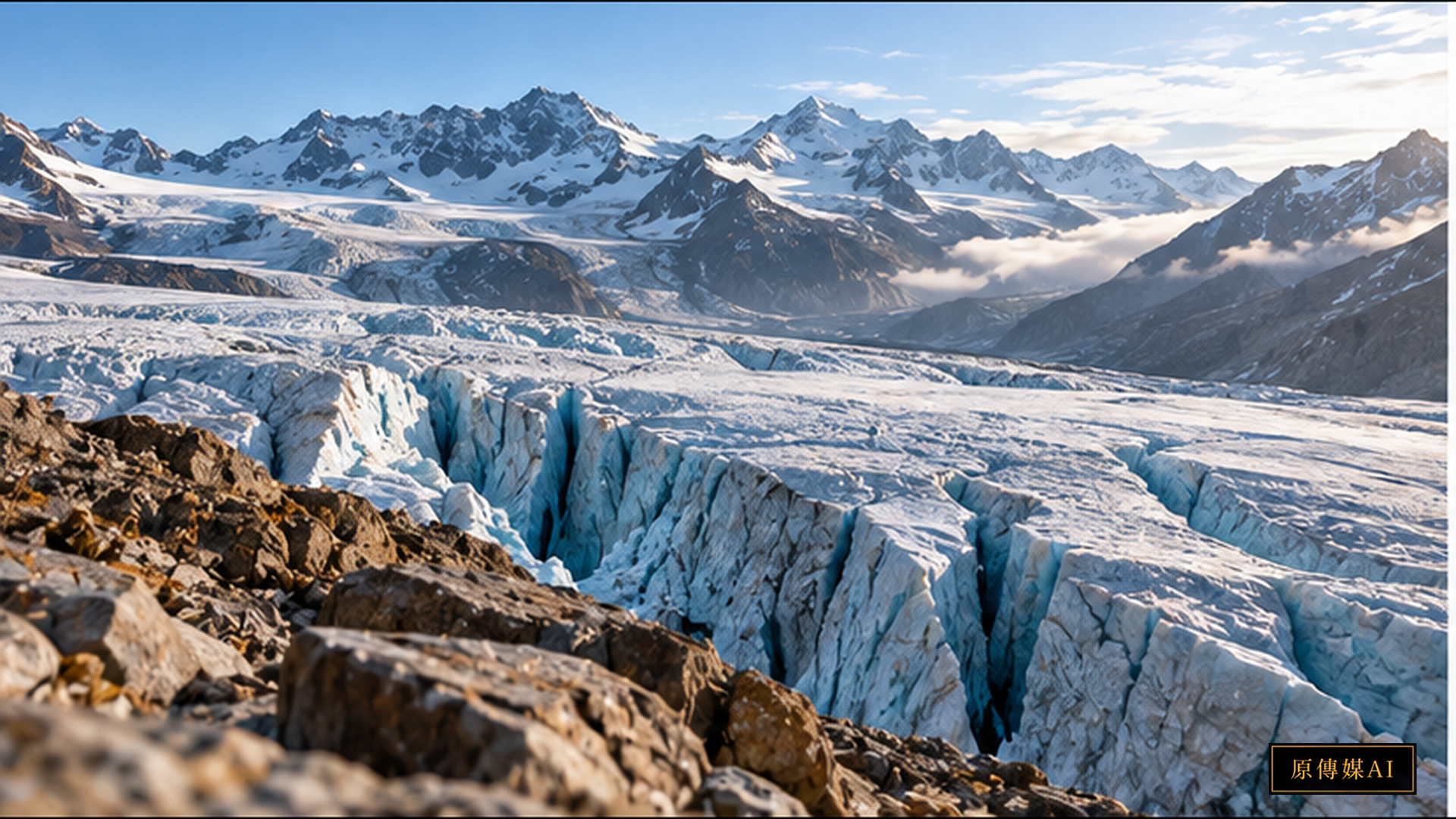
The European Alps have historically been revered as the Water Towers of Europe. For millennia, their vast glacial reserves acted as a natural solid-state freshwater bank, freezing heavy winter snowfalls and releasing steady meltwater during hot, arid summers to sustain baseline discharges across the Rhine, Rhône, Po, and Danube river networks. However, the latest 2025/2026 hydrologic year monitoring report released jointly by Glacier Monitoring Switzerland (GLAMOS) and the Swiss Federal Institute of Technology in Zurich (ETH Zurich) delivers an alarming empirical warning to global climate and water governance authorities. Empirical data demonstrate that following catastrophic, record-setting melt events in 2022 and 2023, Swiss glaciers suffered severe volume losses once again in 2026. Across the five-year window spanning 2022 to 2026, Switzerland's total glacier volume plummeted by nearly one-fifth (approaching 20 percent). This unprecedented rate of cryospheric collapse has transformed glaciology from an academic branch of Earth sciences into an urgent pillar of European energy security, transboundary water treaties, and alpine geohazard mitigation.
Direct Field Measurements and National Models: Auditing the Real Ledger of Mass Balance Loss
According to the comprehensive empirical data compiled in the GLAMOS Annual Mass Balance on Swiss Glaciers 2026 Report, the GLAMOS consortium tracks the health of more than 1,400 Swiss glaciers through an integrated dual-methodological framework: combining high-density direct in-situ glaciological measurements with high-resolution national numerical modeling. At the conclusion of each hydrologic year in late autumn, glaciologists ascend ablation zones and accumulation zones to conduct manual ablation stake drilling, deep ground-penetrating radar (GPR) snowpack surveys, and centimeter-accurate drone photogrammetric flights, auditing ice thickness fluctuations across elevation cross-sections.
The 2026 hydrologic year revealed an extreme cryospheric deficit. Although the Swiss Alps received above-average winter and early spring snowfall during 2025/2026, intense, persistent summer heatwaves combined with repeated atmospheric Saharan dust deposition events severely lowered snowpack surface albedo. Dark mineral dust accelerated shortwave solar radiation absorption, causing protective winter snow blankets to melt completely by mid-July and exposing the coarse, dark underlying glacier ice to solar ablation weeks ahead of historical averages.
According to the analytical synthesis released in the ETH Zurich Swiss Glaciers Devastating Melt Bulletin, the single-year national glacier volume loss in 2026 exceeded 2.5 percent, driving cumulative volume reduction across the 2022–2026 period to nearly 20 percent. Cryospheric scientists stress the vital methodological distinction between localized, stake-measured vertical ice loss and national aggregate volume loss. While in-situ stakes at lower glacier tongues documented vertical melt exceeding three meters in a single summer season, the aggregate loss of one-fifth of Switzerland's ice volume equates to the permanent vaporization of billions of cubic meters of strategic freshwater capital.
Observational Portals and Peak Water: Shifting from Temporary Windfall to Structural Depletion
Faced with massive glacier melt, public observers and political authorities frequently fall into a dangerous cognitive trap, assuming that accelerated melting yields abundant river discharge and relieves summer drought. Challenging this complacency, the long-term hydrologic discharge records curated on the GLAMOS Swiss Glacier Monitoring Figures and Observational Portal expose the severe downstream consequences of the Peak Water paradigm.
During the initial phase of glacial retreat, elevated temperatures release immense volumes of excess meltwater through July and August, rapidly filling alpine hydroelectric reservoirs and supplying downstream agricultural valleys. However, this temporary hydrological windfall represents the non-renewable exhaustion of cryospheric principal. As glacier surface areas and overall volumes shrink past critical thresholds, the basin crosses its Peak Water inflection point, after which summer streamflow declines precipitously.
European hydrological models indicate that most small and medium-sized alpine catchments have either reached or surpassed this Peak Water threshold. Once past this peak, heatwaves occurring in late summer will trigger river discharge deficits of 30 to 50 percent compared to historical baselines. This hydrological contraction provokes cascading economic and geopolitical vulnerabilities: Swiss hydroelectric operators—generating nearly 60 percent of national electricity—face depleted autumn storage and impaired grid stabilization; downstream nuclear power plants and petrochemical hubs along the Rhône and Rhine confront cooling water shortages and thermal discharge limits; and commercial barge navigation along the Rhine risks recurring low-water paralysis.
The Science-to-Policy Gap: Geohazard Vulnerabilities and Transboundary Water Diplomacy
Translating GLAMOS mass balance telemetry into municipal infrastructure planning and transboundary river management involves navigating complex engineering and jurisdictional friction. In high alpine topography, rapid ice retreat uncovers extensive lateral moraines and steep cirque walls stripped of vegetative stabilization. Deprived of the buttressing pressure of massive ice bodies and destabilized by the thermal degradation of permafrost ice-cement, alpine rockfall, debris avalanche, and landslide frequencies have escalated dramatically.
An even more acute catastrophic risk centers on the formation of glacial lakes and subsequent Glacial Lake Outburst Floods (GLOFs). As retreating glacier snouts leave terminal moraine dams impounding meltwater, sudden rock avalanches into these proglacial lakes risk triggering devastating displacement waves, bursting natural moraine dams and inundating tourist settlements, alpine rail lines, and highway bridges downstream. Cantonal hazard agencies across Valais and Graubünden are currently forced to consult GLAMOS retreat maps, spending millions of francs to blast artificial drainage spillways and construct debris-trapping retention dams to stabilize volatile proglacial basins.
On the international stage, alpine glacier melt is reshaping European transboundary water law. Switzerland, France, Germany, and the Netherlands have historically managed shared river basins through multilateral commissions. However, during acute summer droughts, intense conflicts emerge over whether alpine reservoirs should prioritize domestic winter hydropower storage or release regulated flows down the Rhône to safeguard French agricultural irrigation and preserve estuarine ecology. Empirical glaciological datasets cease to be neutral academic observations; they serve as contested legal evidence in high-stakes negotiations over continental energy and food security.
Comparative Lessons for Taiwan's Mountain Water Tower Stewardship
This alpine cryospheric crisis carries profound structural implications for Taiwan. Although Taiwan lacks permanent glaciers, its alpine terrain features one of the highest densities of 3,000-meter peaks on any island globally. The expansive cloud forests, alpine bogs, and subalpine woodlands across the Central, Xueshan, and Yushan mountain ranges function as Taiwan's living green water towers.
Through fog harvesting, thick sphagnum peat retention, and deep bedrock fissure infiltration, these high-altitude ecosystems absorb torrential monsoon and typhoon deluges, steadily discharging baseline flows throughout dry winter and spring months to sustain the Dahan, Dajia, Zhuoshui, and Gaoping river basins. However, just as Swiss glaciers suffer thermal degradation, Taiwan's alpine catchments are under severe climate stress: winter frost durations have diminished, subalpine temperatures are rising, dry seasons are lengthening, and torrential downpours trigger massive debris flows that accelerate reservoir siltation. When lowland industrial hubs face drought, societal attention focuses narrowly on lowland dams or costly desalination plants, neglecting the ecological health of mountain headwaters.
Learning from GLAMOS's century-long systematic monitoring framework, Taiwan must establish a National Alpine Critical Zone Observatory Network, integrating the Forestry and Nature Conservation Agency, Water Resources Agency, National Park Service, and the Council of Indigenous Peoples, Taiwan. This requires deploying automated high-altitude hydrometric stations, utilizing airborne LiDAR to map slope stability, and respecting Indigenous traditional ecological knowledge regarding alpine springs and seasonal microclimates. Embedding mountain ecosystem health metrics into national spatial planning and water allocation frameworks is essential to preserving freshwater resilience in an era of climate disruption.
Conclusion and Future Verifiable Metrics: Anchoring Climate Resilience in Empirical Truth
The loss of nearly one-fifth of Switzerland's glacier volume within five years delivers an undeniable warning to global climate resilience governance: glaciers do not negotiate with political rhetoric, nor do they pause for protracted bureaucratic reviews. Cryospheric contraction provides an unfiltered physical audit of thermal disequilibrium in the Earth system.
To convert mass balance telemetry into durable public governance, policy frameworks must enforce transparent, verifiable benchmarks. Crucial metrics include: continuous acoustic and radar measurement of glacial melt contribution to downstream reservoir storage; rigorous structural inspection and sensor telemetry across artificial proglacial lake drainage spillways; and legally binding adherence rates to minimum ecological flow allocations during transboundary drought emergencies. In Taiwan, this methodology translates into expanding automated baseflow monitoring across alpine catchments, institutionalizing Indigenous co-management of protective headwater forests, and advancing drought warning horizons. Only by grounding climate adaptation in uncompromised, long-term empirical monitoring can human societies secure freshwater security and societal stability against planetary disruption.
References and Further Reading
Role-Driven Inquiry
Yuan Media AI | Guided Questions by Role
Select a role first, then review the complete questions from that perspective; clicking a question will display Yuan Media AI’s response in real time.
Select a role
Glaciologists
Examine the article's evidence, governance boundaries, data rights, and actionable steps from the perspective of a Glaciologists.
Choose a question
AI use and content-safety disclosure
AI assisted in organizing public research and institutional information for this article and its guided questions. Findings, limitations and practical proposals are distinguished. The cover is an AI-generated concept image.