Do Solar Parks Truly Cool Land? Why Satellite Cool Islands Cannot Be Blindly Transferred to Taiwan
Original Chinese title: 光電場真的會讓土地變冷嗎?衛星看到「冷島」為何不能直接套到臺灣原鄉
NASA Landsat highlighted a 2021 study on photovoltaic cool islands across arid solar parks. This article analyzes the physical distinction between LST and ambient temperature, explains why desert cooling cannot be applied to Taiwan's humid mountain slopes, and reviews 2025 urban park remote sensing.
Lawrence Lee
Scholar at the University of Leeds, technology policy observer.
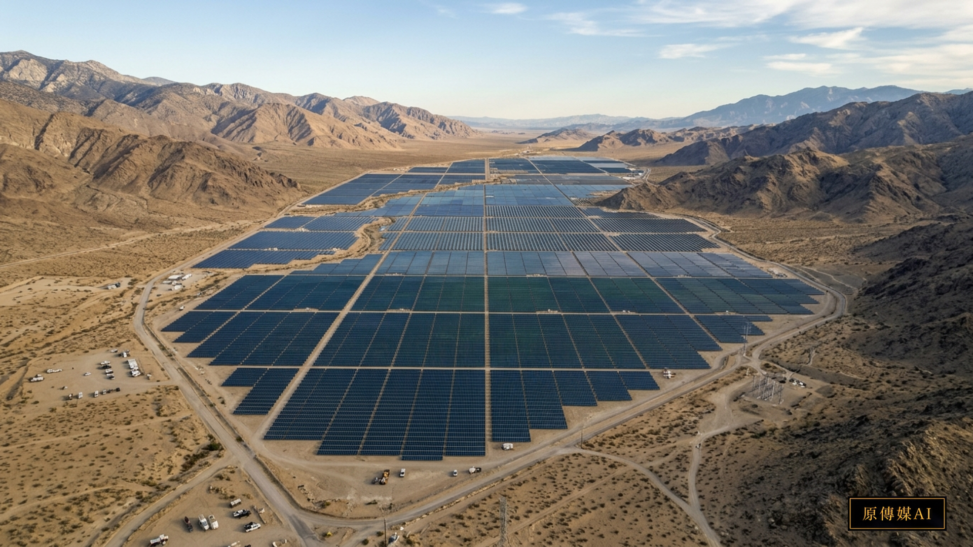
Viewing Earth from high orbital flight, hundreds of thousands of orderly deep-blue photovoltaic modules stretch across the terrain like synthetic reflective lakes. Within prevailing decarbonization narratives, utility-scale photovoltaic solar parks are celebrated as clean energy infrastructures. However, for indigenous communities, farmers, and rural residents residing alongside project boundaries, energy transition is never an abstract carbon offset metric. Instead, it raises concrete socio-ecological concerns: Will vast solar arrays increase or decrease ambient temperatures? Will stormwater runoff trigger slope erosion and mudslides during heavy typhoons? Will native wildlife corridors be permanently disrupted? Will adjacent agriculture experience microclimatic shifts? Confronting these environmental justice issues, public governance must transcend binary political posturing, grounding policy in rigorous empirical telemetry verifiable by local communities.
Retrospect on NASA Landsat Research: Arid Zone Cool Islands and Methodological Boundaries
In October 2021, the NASA Landsat science team published an insightful feature examining how thermal infrared satellite sensors monitor microclimatic impacts surrounding large-scale photovoltaic facilities. As documented on the NASA Landsat Photovoltaic Park Thermal Impact and Cool Island Study, the investigation focused on two utility-scale solar installations located in arid desert basins: the Stateline Solar Farm spanning the California-Nevada border in the Ivanpah Valley, and the Longyangxia solar-hydro complex situated in China's arid Qinghai basin. Researchers synthesized multi-temporal Land Surface Temperature (LST) observations from Landsat missions spanning pre-construction, installation, and operational phases, calibrating satellite retrievals with in-situ meteorological towers.
The empirical finding was the detection of a localized Photovoltaic Cool Island Effect. According to the peer-reviewed study in the Renewable and Sustainable Energy Transition Journal PV Cool Island Paper, during peak solar irradiance at midday, photovoltaic panels shade hyper-arid desert sands, preventing direct solar insolation from heating the surface. Consequently, surface temperatures beneath and adjacent to solar arrays were lower than surrounding unshaded desert terrain. In specific transects, this cooling signature extended up to 700 meters beyond installation perimeters, with land surface temperatures dropping by up to 2.3°C at 100 meters from the site boundaries.
However, scientific rigor mandates maintaining strict evidentiary boundaries: this landmark paper was published in 2021; it represents an established contribution in environmental remote sensing history and must never be falsely presented as a new 2026 discovery. Crucially, empirical datasets were derived exclusively from arid desert biomes characterized by sparse vegetation, minimal precipitation, and low soil thermal capacity. Both NASA science writers and researchers emphasized that arid findings cannot be extrapolated to disparate biomes, nor do they guarantee cooling across other ecosystems.
Fundamental Physical Disparities: Surface Radiative Temperature Distinct from Ambient Air Temperature
In public policy discourse, a common misconception conflates satellite-derived Land Surface Temperature (LST) with ambient air temperature experienced by humans. Satellite thermal sensors capture thermal radiance emitted by the outermost thermodynamic skin of the Earth—whether bare sand, concrete, metallic glass, or vegetative canopy. Emitted radiance depends on surface albedo, thermal inertia, moisture content, and solar incidence angles.
Conversely, standard meteorological air temperature measures kinetic molecular energy within shaded shelters at 1.5 to 2 meters above ground, while human thermal comfort indexes integrate relative humidity, convective wind velocity, and mean radiant temperature. Interpreting a 2.3°C drop in surface radiative heat as a corresponding drop in human physiological thermal stress constitutes a misrepresentation of thermodynamic physics. Under direct solar radiation, photovoltaic silicon surfaces reach temperatures exceeding 50°C to 60°C, emitting longwave thermal radiation that can intensify heat stress downwind. Scientific integrity requires articulating sensor physics and methodological limits, resisting hyperbolic claims of universal environmental improvement.
Taiwan's Island Geography: Humid Subtropical Realities Distinct from Arid Deserts
Contrasting North American desert basins with Taiwan reveals striking socio-ecological disparities. Situated in the subtropical monsoon zone, Taiwan experiences elevated temperatures, high relative humidity, and concentrated precipitation. Indigenous territories span rugged terrain across the Central Mountain Range, alluvial eastern rift valleys, and coastal foothills. Across these island ecosystems, surface energy balances are dominated by vegetative evapotranspiration and hydrological cycles rather than arid radiative diffusion.
In humid montane climates, clearing secondary forests or vegetative cover to install ground-mounted solar arrays produces microclimatic and hydrological consequences contrasting with desert cool island dynamics. Forest canopies actively cool surrounding environments via deep root hydration and continuous foliar transpiration. Replacing living vegetation with metallic mounting racks and solar panels eliminates natural biological cooling while altering surface runoff coefficients. During extreme typhoons, denuded hillsides face severe risks of rill erosion and debris flows. Directly applying arid desert remote sensing data to montane environmental reviews represents an invalid transfer of scientific conclusions.
Methodological Comparisons and Warnings: Distinguishing Urban Parks from Photovoltaic Infrastructure
In digital dissemination and algorithmic indexing, another prevalent fallacy involves synthesizing findings across disparate environmental domains. For instance, a comprehensive study published in Geophysical Research Letters Global Urban Park Cool Island Satellite Study analyzed satellite data across 2,083 cities globally, assessing how urban parks mitigate urban heat island effects. The study confirmed that municipal green spaces mitigate urban heat via canopy shading and biological evapotranspiration, providing analytical tools for urban spatial planning.
While this 2025 paper represents exceptional remote sensing scholarship, analysts must maintain clear physical distinctions: urban park cooling mechanisms rely on active vegetative evapotranspiration, which differs fundamentally from inert shading beneath photovoltaic panels. In environmental journalism or AI knowledge retrieval, extrapolating urban park cooling metrics to justify solar park installations—or suggesting that solar arrays function like municipal forests—constitutes unacceptable evidence distortion. Scientific value lies in methodological precision rather than splicing disparate metrics to support predetermined agendas.
Transparent Territorial Governance: Establishing Community Environmental Telemetry
Amid accelerating renewable energy development, indigenous communities require rigorous co-designed oversight mechanisms rather than promotional public relations brochures. Robust territorial governance requires shared empirical accountability among indigenous communities, academic researchers, and statutory agencies. Any major renewable proposal situated on indigenous territories must establish comprehensive microclimatic baselines at least twelve months prior to ground disturbance.
We propose establishing open-access community microclimatic dashboards: integrating high-resolution orbital imagery from Landsat and Sentinel satellites with localized sensor stations across community settlements, agricultural terraces, and headwater catchments. Telemetry tracking ambient air temperature, relative humidity, wind speed, runoff turbidity, and soil moisture must be accessible to tribal assemblies, subjected to periodic oversight by autonomous community environmental committees. If real-time monitoring detects anomalous thermal accumulation or sediment runoff exceeding regulatory thresholds, communities must retain statutory authority to mandate operational pauses and structural remediation.
Conclusion: Environmental Justice Beyond Superficial Green Labels
The fundamental imperative of the global energy transition is mitigating catastrophic planetary climate disruption. However, if decarbonization initiatives marginalize vulnerable communities or destroy montane watersheds, the transition contradicts its founding ethical principles. NASA's 2021 investigation of photovoltaic surface thermal dynamics reminds society that even silent, non-emitting infrastructures interact with surrounding terrain, hydrological corridors, and human livelihoods.
Rejecting uncritical extrapolation of overseas desert findings, environmental governance must respect Taiwan's diverse montane topographies, fragile island hydrology, and ancestral indigenous memories. Only through rigorous science and respect for territorial sovereignty can society harmonize energy security, ecological integrity, and indigenous self-determination.
Sources and Further Reading
* NASA Landsat Photovoltaic Park Thermal Impact and Cool Island Study
* Renewable and Sustainable Energy Transition Journal PV Cool Island Paper
* Geophysical Research Letters Global Urban Park Cool Island Satellite Study
Role-Driven Inquiry
Yuan Media AI | Guided Questions by Role
Select a role first, then review the complete questions from that perspective; clicking a question will display Yuan Media AI’s response in real time.
Select a role
Cultural Context and Regional Governance
Examine the article's evidence, governance boundaries, data rights, and actionable steps from the perspective of a Cultural Context and Regional Governance.
Choose a question
AI use and content-safety disclosure
AI assisted in organizing public research and institutional information for this article and its guided questions. Findings, limitations and practical proposals are distinguished. The cover is an AI-generated concept image.