Solar Power Is Not Automatically Ecological: A 2,344-County Study Links PV Expansion to Lower Bird Diversity
Original Chinese title: 太陽能不是「放下去就綠」:中國 2,344 個縣的研究發現,光電擴張可能讓鳥種變少
A study covering 2,344 Chinese counties from 2014 to 2023 links policies promoting photovoltaic expansion with lower local bird diversity. The findings shift attention from installed megawatts alone toward habitat heterogeneity, land conversion, and better siting.
陳錦瑜
Professor at National Taiwan University of Science and Technology who teaches courses on chatbots and cultural exploration, interprets Taiwanese culture in relation to international trends, values cultural diversity, and develops SDG-oriented global citizenship and sustainable partnerships.
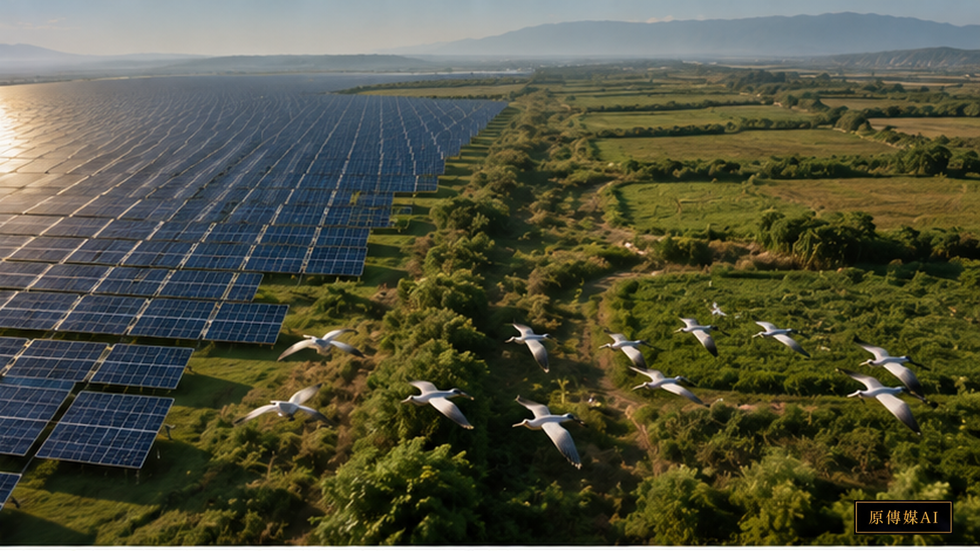
The Second Test of Renewable Energy
Solar photovoltaics are an essential tool for decarbonization, but low-carbon electricity and low ecological impact are not the same concept. A 2026 study built a panel dataset covering 2,344 county-level units in China from 2014 through 2023 and examined the relationship between policies that encouraged photovoltaic expansion and local bird diversity. The reported association was negative, with stronger effects in wealthier, non-desert regions and in places where the original habitat was more structurally complex. The result does not invalidate solar power; it makes land use part of the energy question.
Why Not All Solar Farms Are the Same
The photovoltaic panel itself is only one variable. Siting, grading, access roads, fencing, drainage, vegetation management, and maintenance can all change the landscape. The study points to conversion of cropland and grassland into developed solar sites and to increasing vegetation homogeneity in some areas. A site can therefore remain visually green while losing ecological functions. Birds require combinations of food, nesting space, cover, water, and seasonal resources; leaf area alone is not a complete measure of habitat quality.
Why “Inferior Greening” Is Worth Remembering
The study uses the idea of “inferior greening” to describe a counterintuitive pattern: more leaf area does not automatically mean better ecological quality. If a mosaic of grassland, field margins, shrubs, irrigation features, and small wetlands is replaced by denser but more uniform vegetation, remote sensing may register a greener surface even as birds lose habitat niches. This is a warning against managing energy and biodiversity with a single greenness indicator while ignoring structural complexity and species-specific needs.
The Study Is Not Saying “Do Not Build Solar”
The value of the study is precisely that it moves renewable energy away from slogans and back into siting and landscape design. If the same generation can be placed on rooftops, parking canopies, industrial land, already-developed sites, or areas with lower ecological sensitivity, some habitat conversion can be avoided. Large ground-mounted projects can also retain native vegetation patches, maintain ecological corridors, reduce unnecessary grading, and adjust mowing and nighttime lighting. None of those measures should be assumed effective without monitoring.
Local Knowledge Adds the Seasonal Layer Remote Sensing Misses
Large datasets can compare policy and bird trends across thousands of counties, but bird groups, farmers, and local communities often know information that annual averages cannot capture: which field is used only as a winter stopover, which irrigation ditch remains a dry-season water source, and which field margin provides breeding cover for only a few critical weeks. Those observations should not be added as an appendix after an environmental review. They should modify the map of what is considered suitable for development before project design becomes difficult to change.
Energy Transition Also Requires Spatial Justice
If rural places bear the ecological and land-use costs of photovoltaic development while cities mainly receive the low-carbon electricity, the transition can create a new distributional imbalance. Local participation in siting, the distribution of revenue, compatibility with agriculture, ecological continuity, and post-retirement land restoration are all energy-governance questions. A sustainable transition cannot solve carbon emissions simply by relocating costs into habitat loss or local land conflict.
Taiwan Needs to Move Biodiversity Earlier in the Process
Taiwan combines limited land area, high species density, intensive agriculture, settlements, rivers, wetlands, and mountains at short distances. That makes it especially important to move biodiversity information into the planning stage rather than waiting until a project is already designed. Future assessments should ask not only how much electricity a site can produce, but also which ecological functions the land currently provides, which functions can coexist with generation, and which losses would be difficult or impossible to reverse.
From Megawatts to Multi-Objective Decision-Making
Energy policy is often managed with a single performance metric: installed capacity, annual generation, or avoided carbon. Land, however, simultaneously carries agriculture, biodiversity, water, landscape, culture, and local economic functions. If each agency optimizes only its own metric, the combined result can be worse. Mature energy planning requires multi-objective comparison that includes biodiversity risk, alternative siting, cumulative effects, restoration costs, and distributional fairness before permits narrow the set of available options.
Turning a Research Result into a Publicly Verifiable Question
Any new research result entering public debate should distinguish direct evidence, mechanism, and policy inference. Large-scale statistical evidence is powerful, but it still requires local verification before being used as a deterministic rule for every project. In Taiwan, a practical response would be to establish transparent baselines, preserve failed mitigation cases, compare alternative sites, and document uncertainty. Scientific evidence becomes more useful when planners and local observers can see the same evidence chain and challenge the assumptions built into it.
Bird-Diversity Decline Cannot Be Reduced to a Single “Solar Hurts Birds” Graphic
A national or county-scale statistical association can easily be turned into an oversimplified message that every solar farm has the same ecological effect. That is not what a heterogeneous landscape allows us to conclude. Terrain, previous land cover, project density, vegetation management, and surrounding land use differ. The better policy takeaway is that where and how photovoltaic expansion occurs changes ecological outcomes. The research is a reason for more precise planning, not for replacing one slogan with another.
Farmland Is Not a Single Habitat Type
Planning maps often classify land broadly as cropland, grassland, forest, or built-up area, but birds respond to finer structure. Rice paddies differ from dry fields; fallow plots differ from intensive monoculture; farmland with field margins, channels, shrubs, and scattered trees differs from a completely leveled production landscape. Farmers know water schedules, local bird groups know migration windows, and residents know small wet features that may be used predictably each year. Combining those observations with remote sensing and systematic surveys can improve spatial decisions.
Solar Power and Biodiversity Can Sometimes Be Designed for Coexistence
Some ground-mounted solar sites may support diverse vegetation, reduced chemical mowing, permeable boundaries, and habitat corridors. In some starting landscapes, those practices could improve local ecological conditions. But coexistence must be demonstrated against an honest baseline. A project on paved or highly degraded land has a different ecological starting point from a project on heterogeneous grassland or a wetland margin. Monitoring should therefore cover pre-construction conditions, construction disturbance, operating years, and eventual decommissioning rather than relying on one survey at the permit stage.
Cumulative Effects Are Harder to See Than a Single Project
One project can pass an individual review while a region accumulates many projects over several years. Habitat fragmentation, new roads, altered movement routes, and repeated disturbance may emerge only at the landscape scale. Regional planning therefore needs cumulative-effect assessment rather than asking only whether each project is individually acceptable. Without that wider frame, every local decision can look reasonable while the combined outcome becomes a large ecological loss across a migratory corridor, plain, or watershed.
Siting Data Must Be Open to Reassessment
If governments publish photovoltaic suitability zones, the data version, bird-survey year, land-cover source, and exclusion rules should also be public. Habitats change, species shift, and land uses evolve; a suitability map should not become permanent simply because it was once approved. Periodic updates, local evidence submissions, and a documented correction mechanism can prevent an old “low sensitivity” classification from becoming the basis for a high-risk project years later. Good siting is a continuing data-governance process, not a one-time map.
Main References
AI use and content-safety disclosure
This article was organized and reviewed through the Yuan Media AI editorial process. AI-assisted translation was used with human editorial responsibility for factual accuracy and source fidelity.